You are here: Home > Network List > US - United States National Seismic Network Stations List
> Station EGMT Eagleton, Montana, USA > Earthquake Result Viewer
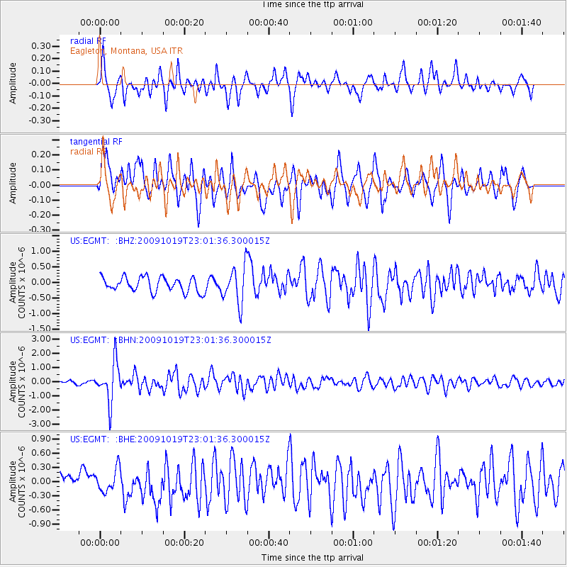
EGMT Eagleton, Montana, USA - Earthquake Result Viewer
*The percent match for this event was below the threshold and hence no stack was calculated.
| Earthquake location: |
Samoa Islands Region |
| Earthquake latitude/longitude: |
-15.4/-172.3 |
| Earthquake time(UTC): |
2009/10/19 (292) 22:49:38 GMT |
| Earthquake Depth: |
18 km |
| Earthquake Magnitude: |
6.2 MB, 5.7 MS, 6.0 MW, 5.9 MW |
| Earthquake Catalog/Contributor: |
WHDF/NEIC |
|
| Network: |
US United States National Seismic Network |
| Station: |
EGMT Eagleton, Montana, USA |
| Lat/Lon: |
48.02 N/109.75 W |
| Elevation: |
1055 m |
|
| Distance: |
84.0 deg |
| Az: |
36.779 deg |
| Baz: |
239.367 deg |
| Ray Param: |
$rayparam |
*The percent match for this event was below the threshold and hence was not used in the summary stack. |
|
| Radial Match: |
67.42991 % |
| Radial Bump: |
322 |
| Transverse Match: |
68.04173 % |
| Transverse Bump: |
400 |
| SOD ConfigId: |
2622 |
| Insert Time: |
2010-03-05 07:27:51.270 +0000 |
| GWidth: |
2.5 |
| Max Bumps: |
400 |
| Tol: |
0.001 |
|
Signal To Noise
| Channel | StoN | STA | LTA |
| US:EGMT: :BHN:20091019T23:01:36.300015Z | 10.133198 | 1.4545593E-6 | 1.4354396E-7 |
| US:EGMT: :BHE:20091019T23:01:36.300015Z | 1.2532631 | 2.5029266E-7 | 1.9971277E-7 |
| US:EGMT: :BHZ:20091019T23:01:36.300015Z | 2.6776884 | 6.200712E-7 | 2.3156959E-7 |
| Arrivals |
| Ps | |
| PpPs | |
| PsPs/PpSs | |


