You are here: Home > Network List > US - United States National Seismic Network Stations List
> Station EGMT Eagleton, Montana, USA > Earthquake Result Viewer
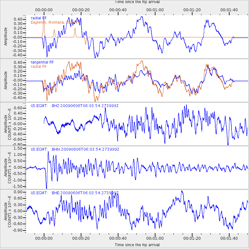
EGMT Eagleton, Montana, USA - Earthquake Result Viewer
*The percent match for this event was below the threshold and hence no stack was calculated.
| Earthquake location: |
Near East Coast Of Honshu, Japan |
| Earthquake latitude/longitude: |
35.5/140.9 |
| Earthquake time(UTC): |
2009/06/06 (157) 05:52:43 GMT |
| Earthquake Depth: |
34 km |
| Earthquake Magnitude: |
5.8 MB, 5.4 MS, 5.8 MW, 5.7 MW |
| Earthquake Catalog/Contributor: |
WHDF/NEIC |
|
| Network: |
US United States National Seismic Network |
| Station: |
EGMT Eagleton, Montana, USA |
| Lat/Lon: |
48.02 N/109.75 W |
| Elevation: |
1055 m |
|
| Distance: |
75.7 deg |
| Az: |
40.821 deg |
| Baz: |
307.371 deg |
| Ray Param: |
$rayparam |
*The percent match for this event was below the threshold and hence was not used in the summary stack. |
|
| Radial Match: |
45.5864 % |
| Radial Bump: |
400 |
| Transverse Match: |
58.646873 % |
| Transverse Bump: |
400 |
| SOD ConfigId: |
2648 |
| Insert Time: |
2010-03-05 07:28:01.785 +0000 |
| GWidth: |
2.5 |
| Max Bumps: |
400 |
| Tol: |
0.001 |
|
Signal To Noise
| Channel | StoN | STA | LTA |
| US:EGMT: :BHN:20090606T06:03:54.273999Z | 10.183765 | 6.941443E-7 | 6.816185E-8 |
| US:EGMT: :BHE:20090606T06:03:54.273999Z | 2.1018112 | 3.8692627E-7 | 1.8409183E-7 |
| US:EGMT: :BHZ:20090606T06:03:54.273999Z | 2.1029136 | 2.9979714E-7 | 1.4256274E-7 |
| Arrivals |
| Ps | |
| PpPs | |
| PsPs/PpSs | |


