You are here: Home > Network List > GS - US Geological Survey Networks Stations List
> Station DEC06 Boomer > Earthquake Result Viewer
DEC06 Boomer - Earthquake Result Viewer
*The percent match for this event was below the threshold and hence no stack was calculated.
| Earthquake location: |
Central Mid-Atlantic Ridge |
| Earthquake latitude/longitude: |
7.1/-34.3 |
| Earthquake time(UTC): |
2016/10/05 (279) 20:53:39 GMT |
| Earthquake Depth: |
10 km |
| Earthquake Magnitude: |
5.5 mwb |
| Earthquake Catalog/Contributor: |
NEIC PDE/ |
|
| Network: |
GS US Geological Survey Networks |
| Station: |
DEC06 Boomer |
| Lat/Lon: |
39.90 N/88.95 W |
| Elevation: |
215 m |
|
| Distance: |
58.6 deg |
| Az: |
312.704 deg |
| Baz: |
108.575 deg |
| Ray Param: |
$rayparam |
*The percent match for this event was below the threshold and hence was not used in the summary stack. |
|
| Radial Match: |
23.889215 % |
| Radial Bump: |
400 |
| Transverse Match: |
21.709259 % |
| Transverse Bump: |
400 |
| SOD ConfigId: |
11737051 |
| Insert Time: |
2019-04-25 16:48:20.061 +0000 |
| GWidth: |
2.5 |
| Max Bumps: |
400 |
| Tol: |
0.001 |
|
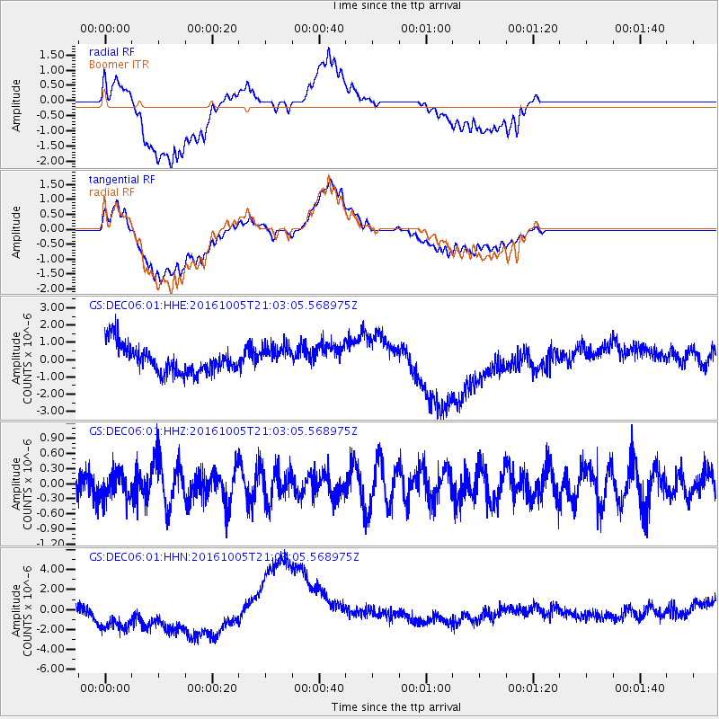
Signal To Noise
| Channel | StoN | STA | LTA |
| GS:DEC06:01:HHZ:20161005T21:03:05.568975Z | 1.0740978 | 2.6696017E-7 | 2.4854364E-7 |
| GS:DEC06:01:HHN:20161005T21:03:05.568975Z | 1.3073827 | 1.8739855E-6 | 1.4333872E-6 |
| GS:DEC06:01:HHE:20161005T21:03:05.568975Z | 0.89115113 | 7.0935835E-7 | 7.9600227E-7 |
| Arrivals |
| Ps | |
| PpPs | |
| PsPs/PpSs | |


