You are here: Home > Network List > GS - US Geological Survey Networks Stations List
> Station OK051 E0350 and S34600 Roads, Ralston, OK > Earthquake Result Viewer
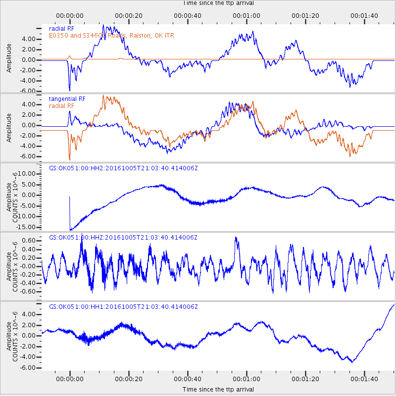
OK051 E0350 and S34600 Roads, Ralston, OK - Earthquake Result Viewer
*The percent match for this event was below the threshold and hence no stack was calculated.
| Earthquake location: |
Central Mid-Atlantic Ridge |
| Earthquake latitude/longitude: |
7.1/-34.3 |
| Earthquake time(UTC): |
2016/10/05 (279) 20:53:39 GMT |
| Earthquake Depth: |
10 km |
| Earthquake Magnitude: |
5.5 mwb |
| Earthquake Catalog/Contributor: |
NEIC PDE/ |
|
| Network: |
GS US Geological Survey Networks |
| Station: |
OK051 E0350 and S34600 Roads, Ralston, OK |
| Lat/Lon: |
36.51 N/96.84 W |
| Elevation: |
263 m |
|
| Distance: |
63.8 deg |
| Az: |
307.163 deg |
| Baz: |
101.035 deg |
| Ray Param: |
$rayparam |
*The percent match for this event was below the threshold and hence was not used in the summary stack. |
|
| Radial Match: |
48.485718 % |
| Radial Bump: |
400 |
| Transverse Match: |
43.618057 % |
| Transverse Bump: |
400 |
| SOD ConfigId: |
11737051 |
| Insert Time: |
2019-04-25 16:48:28.388 +0000 |
| GWidth: |
2.5 |
| Max Bumps: |
400 |
| Tol: |
0.001 |
|
Signal To Noise
| Channel | StoN | STA | LTA |
| GS:OK051:00:HHZ:20161005T21:03:40.414006Z | 1.7743086 | 2.4847463E-7 | 1.4004027E-7 |
| GS:OK051:00:HH1:20161005T21:03:40.414006Z | 1.0397341 | 7.4036393E-7 | 7.120704E-7 |
| GS:OK051:00:HH2:20161005T21:03:40.414006Z | 1.5400689 | 8.946779E-6 | 5.809337E-6 |
| Arrivals |
| Ps | |
| PpPs | |
| PsPs/PpSs | |


