You are here: Home > Network List > US - United States National Seismic Network Stations List
> Station EGMT Eagleton, Montana, USA > Earthquake Result Viewer
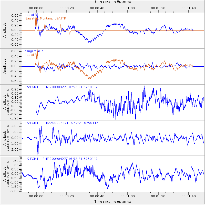
EGMT Eagleton, Montana, USA - Earthquake Result Viewer
*The percent match for this event was below the threshold and hence no stack was calculated.
| Earthquake location: |
Guerrero, Mexico |
| Earthquake latitude/longitude: |
17.0/-99.4 |
| Earthquake time(UTC): |
2009/04/27 (117) 16:46:28 GMT |
| Earthquake Depth: |
35 km |
| Earthquake Magnitude: |
5.7 MB, 5.4 MS, 5.8 MW, 5.8 MW |
| Earthquake Catalog/Contributor: |
WHDF/NEIC |
|
| Network: |
US United States National Seismic Network |
| Station: |
EGMT Eagleton, Montana, USA |
| Lat/Lon: |
48.02 N/109.75 W |
| Elevation: |
1055 m |
|
| Distance: |
32.0 deg |
| Az: |
346.914 deg |
| Baz: |
161.176 deg |
| Ray Param: |
$rayparam |
*The percent match for this event was below the threshold and hence was not used in the summary stack. |
|
| Radial Match: |
39.48924 % |
| Radial Bump: |
400 |
| Transverse Match: |
59.951077 % |
| Transverse Bump: |
400 |
| SOD ConfigId: |
2658 |
| Insert Time: |
2010-03-05 07:28:22.539 +0000 |
| GWidth: |
2.5 |
| Max Bumps: |
400 |
| Tol: |
0.001 |
|
Signal To Noise
| Channel | StoN | STA | LTA |
| US:EGMT: :BHN:20090427T16:52:21.675011Z | 11.736954 | 1.1470486E-6 | 9.772967E-8 |
| US:EGMT: :BHE:20090427T16:52:21.675011Z | 2.0357566 | 1.0213067E-6 | 5.016841E-7 |
| US:EGMT: :BHZ:20090427T16:52:21.675011Z | 1.7919759 | 4.7475896E-7 | 2.6493603E-7 |
| Arrivals |
| Ps | |
| PpPs | |
| PsPs/PpSs | |


