You are here: Home > Network List > US - United States National Seismic Network Stations List
> Station EGMT Eagleton, Montana, USA > Earthquake Result Viewer
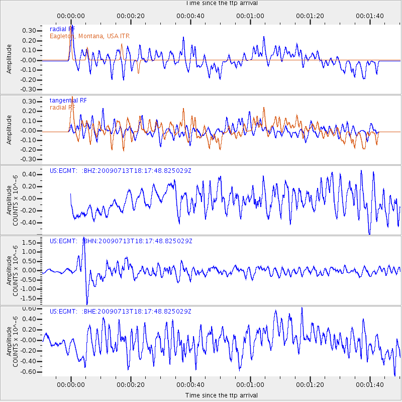
EGMT Eagleton, Montana, USA - Earthquake Result Viewer
*The percent match for this event was below the threshold and hence no stack was calculated.
| Earthquake location: |
Taiwan Region |
| Earthquake latitude/longitude: |
24.1/122.2 |
| Earthquake time(UTC): |
2009/07/13 (194) 18:05:01 GMT |
| Earthquake Depth: |
17 km |
| Earthquake Magnitude: |
6.1 MB, 6.3 MS, 6.3 MW, 6.2 MW |
| Earthquake Catalog/Contributor: |
WHDF/NEIC |
|
| Network: |
US United States National Seismic Network |
| Station: |
EGMT Eagleton, Montana, USA |
| Lat/Lon: |
48.02 N/109.75 W |
| Elevation: |
1055 m |
|
| Distance: |
94.5 deg |
| Az: |
32.024 deg |
| Baz: |
313.77 deg |
| Ray Param: |
$rayparam |
*The percent match for this event was below the threshold and hence was not used in the summary stack. |
|
| Radial Match: |
40.020844 % |
| Radial Bump: |
400 |
| Transverse Match: |
55.673203 % |
| Transverse Bump: |
400 |
| SOD ConfigId: |
2648 |
| Insert Time: |
2010-03-05 07:28:28.452 +0000 |
| GWidth: |
2.5 |
| Max Bumps: |
400 |
| Tol: |
0.001 |
|
Signal To Noise
| Channel | StoN | STA | LTA |
| US:EGMT: :BHN:20090713T18:17:48.825029Z | 12.061355 | 6.6921984E-7 | 5.548463E-8 |
| US:EGMT: :BHE:20090713T18:17:48.825029Z | 2.0185997 | 4.9262337E-7 | 2.4404213E-7 |
| US:EGMT: :BHZ:20090713T18:17:48.825029Z | 2.1458907 | 2.9152548E-7 | 1.358529E-7 |
| Arrivals |
| Ps | |
| PpPs | |
| PsPs/PpSs | |


