You are here: Home > Network List > US - United States National Seismic Network Stations List
> Station EGMT Eagleton, Montana, USA > Earthquake Result Viewer
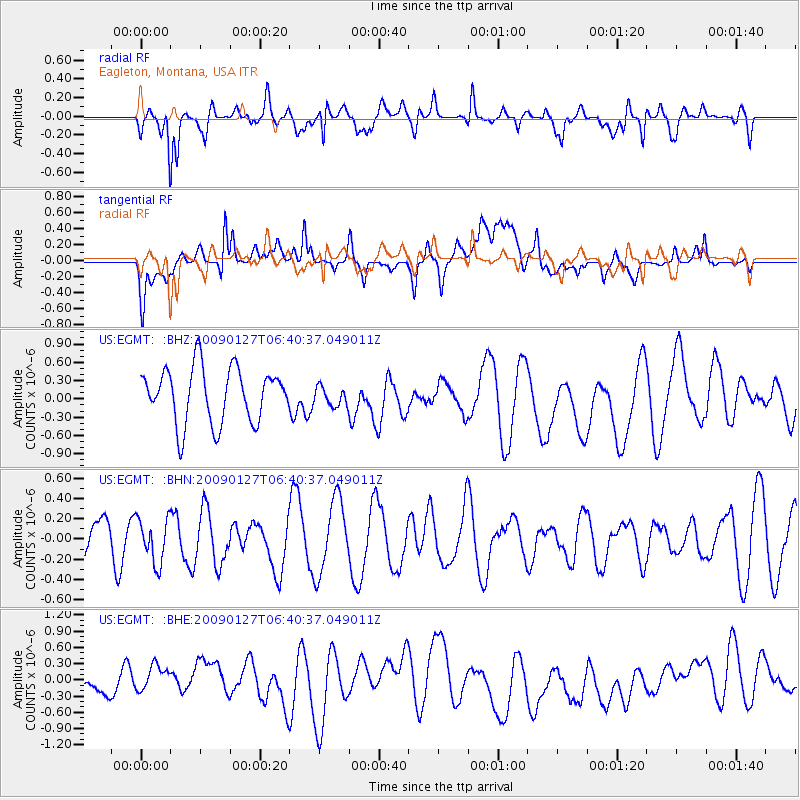
EGMT Eagleton, Montana, USA - Earthquake Result Viewer
*The percent match for this event was below the threshold and hence no stack was calculated.
| Earthquake location: |
Fiji Islands Region |
| Earthquake latitude/longitude: |
-17.8/-178.7 |
| Earthquake time(UTC): |
2009/01/27 (027) 06:29:13 GMT |
| Earthquake Depth: |
601 km |
| Earthquake Magnitude: |
5.9 MW, 5.1 MB, 5.8 MW |
| Earthquake Catalog/Contributor: |
WHDF/NEIC |
|
| Network: |
US United States National Seismic Network |
| Station: |
EGMT Eagleton, Montana, USA |
| Lat/Lon: |
48.02 N/109.75 W |
| Elevation: |
1055 m |
|
| Distance: |
89.8 deg |
| Az: |
38.784 deg |
| Baz: |
242.724 deg |
| Ray Param: |
$rayparam |
*The percent match for this event was below the threshold and hence was not used in the summary stack. |
|
| Radial Match: |
62.36892 % |
| Radial Bump: |
400 |
| Transverse Match: |
55.970707 % |
| Transverse Bump: |
400 |
| SOD ConfigId: |
2658 |
| Insert Time: |
2010-03-05 07:28:44.111 +0000 |
| GWidth: |
2.5 |
| Max Bumps: |
400 |
| Tol: |
0.001 |
|
Signal To Noise
| Channel | StoN | STA | LTA |
| US:EGMT: :BHN:20090127T06:40:37.049011Z | 0.6885952 | 2.1818974E-7 | 3.1686213E-7 |
| US:EGMT: :BHE:20090127T06:40:37.049011Z | 1.2149646 | 3.086023E-7 | 2.5400107E-7 |
| US:EGMT: :BHZ:20090127T06:40:37.049011Z | 0.35923377 | 1.6078803E-7 | 4.4758605E-7 |
| Arrivals |
| Ps | |
| PpPs | |
| PsPs/PpSs | |


