You are here: Home > Network List > US - United States National Seismic Network Stations List
> Station EGMT Eagleton, Montana, USA > Earthquake Result Viewer
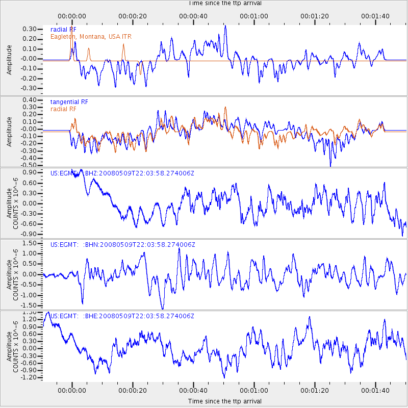
EGMT Eagleton, Montana, USA - Earthquake Result Viewer
*The percent match for this event was below the threshold and hence no stack was calculated.
| Earthquake location: |
South Of Mariana Islands |
| Earthquake latitude/longitude: |
12.5/143.2 |
| Earthquake time(UTC): |
2008/05/09 (130) 21:51:29 GMT |
| Earthquake Depth: |
76 km |
| Earthquake Magnitude: |
6.1 MB, 6.7 MW, 6.7 MW |
| Earthquake Catalog/Contributor: |
WHDF/NEIC |
|
| Network: |
US United States National Seismic Network |
| Station: |
EGMT Eagleton, Montana, USA |
| Lat/Lon: |
48.02 N/109.75 W |
| Elevation: |
1055 m |
|
| Distance: |
91.9 deg |
| Az: |
39.948 deg |
| Baz: |
290.924 deg |
| Ray Param: |
$rayparam |
*The percent match for this event was below the threshold and hence was not used in the summary stack. |
|
| Radial Match: |
34.830334 % |
| Radial Bump: |
400 |
| Transverse Match: |
47.034847 % |
| Transverse Bump: |
400 |
| SOD ConfigId: |
2504 |
| Insert Time: |
2010-03-05 07:28:52.821 +0000 |
| GWidth: |
2.5 |
| Max Bumps: |
400 |
| Tol: |
0.001 |
|
Signal To Noise
| Channel | StoN | STA | LTA |
| US:EGMT: :BHN:20080509T22:03:58.274006Z | 5.871118 | 4.797229E-7 | 8.1708954E-8 |
| US:EGMT: :BHE:20080509T22:03:58.274006Z | 0.5320713 | 5.8738357E-7 | 1.1039565E-6 |
| US:EGMT: :BHZ:20080509T22:03:58.274006Z | 1.0568595 | 5.152021E-7 | 4.87484E-7 |
| Arrivals |
| Ps | |
| PpPs | |
| PsPs/PpSs | |


