You are here: Home > Network List > US - United States National Seismic Network Stations List
> Station EGMT Eagleton, Montana, USA > Earthquake Result Viewer
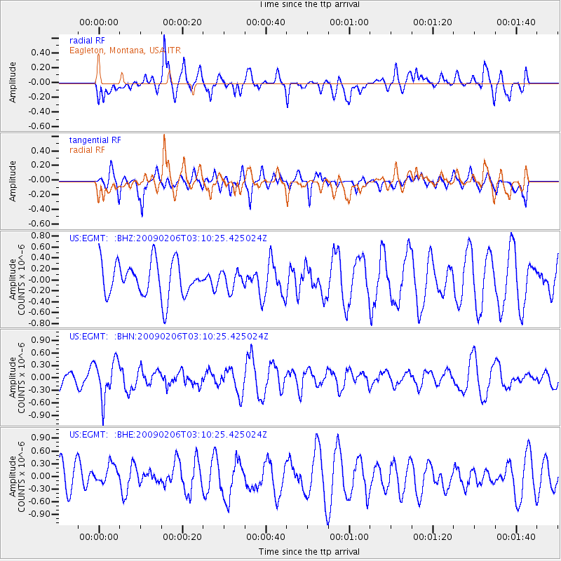
EGMT Eagleton, Montana, USA - Earthquake Result Viewer
*The percent match for this event was below the threshold and hence no stack was calculated.
| Earthquake location: |
Near Coast Of Northern Chile |
| Earthquake latitude/longitude: |
-28.0/-71.1 |
| Earthquake time(UTC): |
2009/02/06 (037) 02:58:35 GMT |
| Earthquake Depth: |
52 km |
| Earthquake Magnitude: |
5.5 MB |
| Earthquake Catalog/Contributor: |
WHDF/NEIC |
|
| Network: |
US United States National Seismic Network |
| Station: |
EGMT Eagleton, Montana, USA |
| Lat/Lon: |
48.02 N/109.75 W |
| Elevation: |
1055 m |
|
| Distance: |
83.2 deg |
| Az: |
335.026 deg |
| Baz: |
146.206 deg |
| Ray Param: |
$rayparam |
*The percent match for this event was below the threshold and hence was not used in the summary stack. |
|
| Radial Match: |
47.56214 % |
| Radial Bump: |
400 |
| Transverse Match: |
50.37778 % |
| Transverse Bump: |
400 |
| SOD ConfigId: |
2658 |
| Insert Time: |
2010-03-05 07:28:59.562 +0000 |
| GWidth: |
2.5 |
| Max Bumps: |
400 |
| Tol: |
0.001 |
|
Signal To Noise
| Channel | StoN | STA | LTA |
| US:EGMT: :BHN:20090206T03:10:25.425024Z | 3.09846 | 4.5007374E-7 | 1.4525725E-7 |
| US:EGMT: :BHE:20090206T03:10:25.425024Z | 0.8689102 | 2.5112556E-7 | 2.890121E-7 |
| US:EGMT: :BHZ:20090206T03:10:25.425024Z | 0.5206116 | 1.6601982E-7 | 3.1889383E-7 |
| Arrivals |
| Ps | |
| PpPs | |
| PsPs/PpSs | |


