You are here: Home > Network List > G - GEOSCOPE Stations List
> Station MPG Montagne des Peres, French Guyana > Earthquake Result Viewer
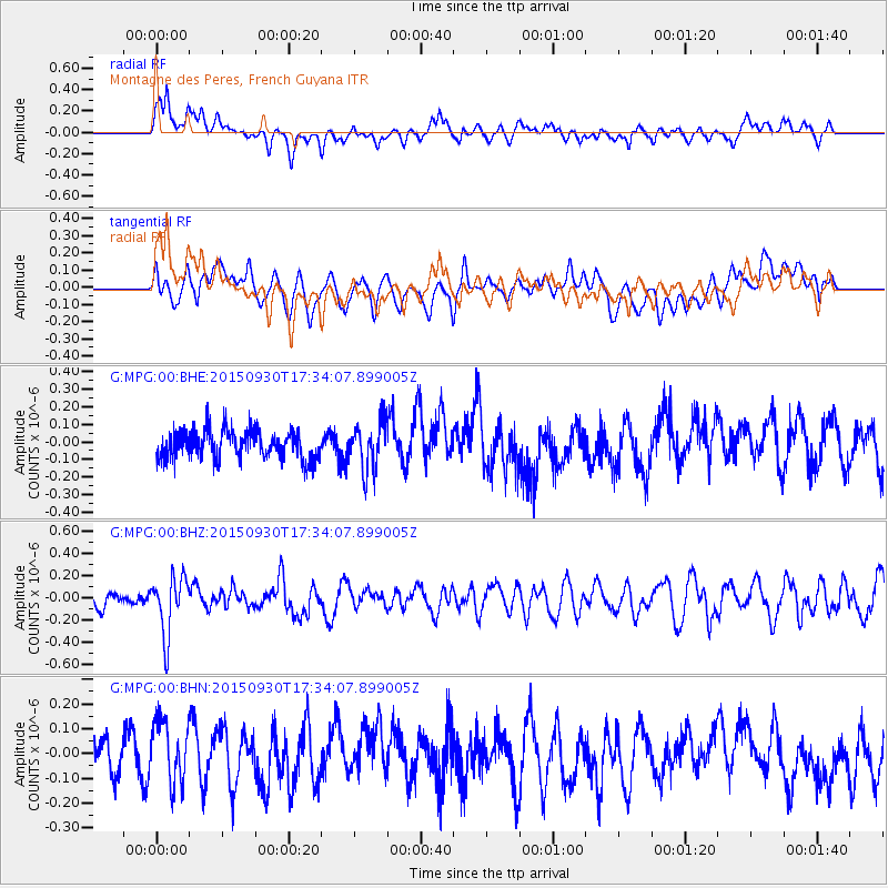
MPG Montagne des Peres, French Guyana - Earthquake Result Viewer
*The percent match for this event was below the threshold and hence no stack was calculated.
| Earthquake location: |
Guerrero, Mexico |
| Earthquake latitude/longitude: |
18.1/-101.3 |
| Earthquake time(UTC): |
2015/09/30 (273) 17:25:56 GMT |
| Earthquake Depth: |
65 km |
| Earthquake Magnitude: |
5.5 MB |
| Earthquake Catalog/Contributor: |
NEIC PDE/NEIC COMCAT |
|
| Network: |
G GEOSCOPE |
| Station: |
MPG Montagne des Peres, French Guyana |
| Lat/Lon: |
5.11 N/52.64 W |
| Elevation: |
147 m |
|
| Distance: |
49.2 deg |
| Az: |
99.046 deg |
| Baz: |
289.433 deg |
| Ray Param: |
$rayparam |
*The percent match for this event was below the threshold and hence was not used in the summary stack. |
|
| Radial Match: |
65.830864 % |
| Radial Bump: |
400 |
| Transverse Match: |
61.91738 % |
| Transverse Bump: |
400 |
| SOD ConfigId: |
1156111 |
| Insert Time: |
2015-10-14 17:39:17.465 +0000 |
| GWidth: |
2.5 |
| Max Bumps: |
400 |
| Tol: |
0.001 |
|
Signal To Noise
| Channel | StoN | STA | LTA |
| G:MPG:00:BHZ:20150930T17:34:07.899005Z | 3.413054 | 2.6169874E-7 | 7.6675825E-8 |
| G:MPG:00:BHN:20150930T17:34:07.899005Z | 1.652352 | 1.2676603E-7 | 7.6718536E-8 |
| G:MPG:00:BHE:20150930T17:34:07.899005Z | 1.6613859 | 1.3508503E-7 | 8.130865E-8 |
| Arrivals |
| Ps | |
| PpPs | |
| PsPs/PpSs | |


