You are here: Home > Network List > US - United States National Seismic Network Stations List
> Station EGMT Eagleton, Montana, USA > Earthquake Result Viewer
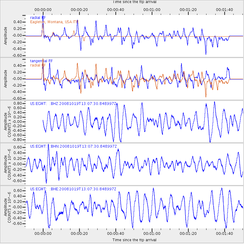
EGMT Eagleton, Montana, USA - Earthquake Result Viewer
*The percent match for this event was below the threshold and hence no stack was calculated.
| Earthquake location: |
Tonga Islands |
| Earthquake latitude/longitude: |
-22.0/-173.7 |
| Earthquake time(UTC): |
2008/10/19 (293) 12:55:05 GMT |
| Earthquake Depth: |
35 km |
| Earthquake Magnitude: |
5.7 MB, 5.3 MS, 5.6 MW, 5.5 MW |
| Earthquake Catalog/Contributor: |
WHDF/NEIC |
|
| Network: |
US United States National Seismic Network |
| Station: |
EGMT Eagleton, Montana, USA |
| Lat/Lon: |
48.02 N/109.75 W |
| Elevation: |
1055 m |
|
| Distance: |
90.1 deg |
| Az: |
37.091 deg |
| Baz: |
236.502 deg |
| Ray Param: |
$rayparam |
*The percent match for this event was below the threshold and hence was not used in the summary stack. |
|
| Radial Match: |
46.941387 % |
| Radial Bump: |
400 |
| Transverse Match: |
59.746597 % |
| Transverse Bump: |
400 |
| SOD ConfigId: |
2556 |
| Insert Time: |
2010-03-05 07:29:17.000 +0000 |
| GWidth: |
2.5 |
| Max Bumps: |
400 |
| Tol: |
0.001 |
|
Signal To Noise
| Channel | StoN | STA | LTA |
| US:EGMT: :BHN:20081019T13:07:30.848997Z | 2.3014812 | 3.2480878E-7 | 1.4113031E-7 |
| US:EGMT: :BHE:20081019T13:07:30.848997Z | 1.5403992 | 4.269436E-7 | 2.7716425E-7 |
| US:EGMT: :BHZ:20081019T13:07:30.848997Z | 0.9475304 | 2.619368E-7 | 2.7644157E-7 |
| Arrivals |
| Ps | |
| PpPs | |
| PsPs/PpSs | |


