You are here: Home > Network List > US - United States National Seismic Network Stations List
> Station EGMT Eagleton, Montana, USA > Earthquake Result Viewer
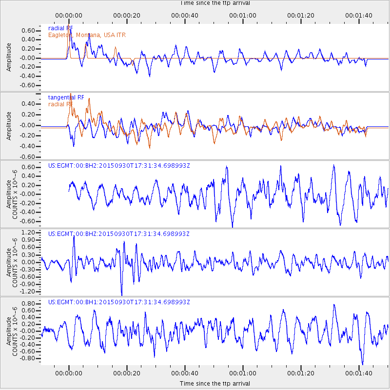
EGMT Eagleton, Montana, USA - Earthquake Result Viewer
*The percent match for this event was below the threshold and hence no stack was calculated.
| Earthquake location: |
Guerrero, Mexico |
| Earthquake latitude/longitude: |
18.1/-101.3 |
| Earthquake time(UTC): |
2015/09/30 (273) 17:25:56 GMT |
| Earthquake Depth: |
65 km |
| Earthquake Magnitude: |
5.5 MB |
| Earthquake Catalog/Contributor: |
NEIC PDE/NEIC COMCAT |
|
| Network: |
US United States National Seismic Network |
| Station: |
EGMT Eagleton, Montana, USA |
| Lat/Lon: |
48.02 N/109.75 W |
| Elevation: |
1055 m |
|
| Distance: |
30.6 deg |
| Az: |
348.813 deg |
| Baz: |
164.044 deg |
| Ray Param: |
$rayparam |
*The percent match for this event was below the threshold and hence was not used in the summary stack. |
|
| Radial Match: |
62.775635 % |
| Radial Bump: |
400 |
| Transverse Match: |
54.810307 % |
| Transverse Bump: |
400 |
| SOD ConfigId: |
1156111 |
| Insert Time: |
2015-10-14 17:42:16.153 +0000 |
| GWidth: |
2.5 |
| Max Bumps: |
400 |
| Tol: |
0.001 |
|
Signal To Noise
| Channel | StoN | STA | LTA |
| US:EGMT:00:BHZ:20150930T17:31:34.698993Z | 3.9572942 | 4.0324986E-7 | 1.019004E-7 |
| US:EGMT:00:BH1:20150930T17:31:34.698993Z | 1.7628379 | 3.4432077E-7 | 1.9532186E-7 |
| US:EGMT:00:BH2:20150930T17:31:34.698993Z | 1.2281293 | 1.850862E-7 | 1.5070579E-7 |
| Arrivals |
| Ps | |
| PpPs | |
| PsPs/PpSs | |


