You are here: Home > Network List > G - GEOSCOPE Stations List
> Station MPG Montagne des Peres, French Guyana > Earthquake Result Viewer
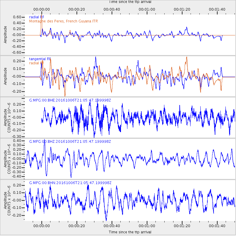
MPG Montagne des Peres, French Guyana - Earthquake Result Viewer
*The percent match for this event was below the threshold and hence no stack was calculated.
| Earthquake location: |
Central East Pacific Rise |
| Earthquake latitude/longitude: |
-4.0/-103.9 |
| Earthquake time(UTC): |
2016/10/06 (280) 20:57:08 GMT |
| Earthquake Depth: |
10 km |
| Earthquake Magnitude: |
5.6 mwb |
| Earthquake Catalog/Contributor: |
NEIC PDE/ |
|
| Network: |
G GEOSCOPE |
| Station: |
MPG Montagne des Peres, French Guyana |
| Lat/Lon: |
5.11 N/52.64 W |
| Elevation: |
147 m |
|
| Distance: |
52.0 deg |
| Az: |
80.367 deg |
| Baz: |
260.877 deg |
| Ray Param: |
$rayparam |
*The percent match for this event was below the threshold and hence was not used in the summary stack. |
|
| Radial Match: |
53.988644 % |
| Radial Bump: |
400 |
| Transverse Match: |
55.45777 % |
| Transverse Bump: |
400 |
| SOD ConfigId: |
11737051 |
| Insert Time: |
2019-04-25 17:07:55.005 +0000 |
| GWidth: |
2.5 |
| Max Bumps: |
400 |
| Tol: |
0.001 |
|
Signal To Noise
| Channel | StoN | STA | LTA |
| G:MPG:00:BHZ:20161006T21:05:47.199998Z | 2.3202546 | 1.991072E-7 | 8.581265E-8 |
| G:MPG:00:BHN:20161006T21:05:47.199998Z | 1.0275302 | 7.89398E-8 | 7.68248E-8 |
| G:MPG:00:BHE:20161006T21:05:47.199998Z | 1.718484 | 1.5621912E-7 | 9.090519E-8 |
| Arrivals |
| Ps | |
| PpPs | |
| PsPs/PpSs | |


