You are here: Home > Network List > TA - USArray Transportable Network (new EarthScope stations) Stations List
> Station R32K Eaglecrest, AK, USA > Earthquake Result Viewer
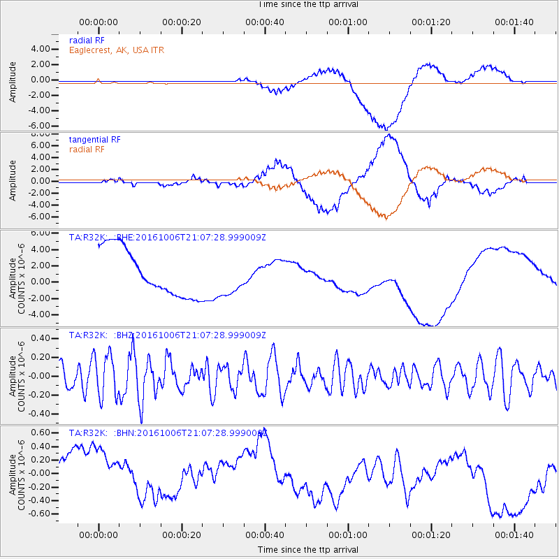
R32K Eaglecrest, AK, USA - Earthquake Result Viewer
*The percent match for this event was below the threshold and hence no stack was calculated.
| Earthquake location: |
Central East Pacific Rise |
| Earthquake latitude/longitude: |
-4.0/-103.9 |
| Earthquake time(UTC): |
2016/10/06 (280) 20:57:08 GMT |
| Earthquake Depth: |
10 km |
| Earthquake Magnitude: |
5.6 mwb |
| Earthquake Catalog/Contributor: |
NEIC PDE/ |
|
| Network: |
TA USArray Transportable Network (new EarthScope stations) |
| Station: |
R32K Eaglecrest, AK, USA |
| Lat/Lon: |
58.27 N/134.52 W |
| Elevation: |
386 m |
|
| Distance: |
66.8 deg |
| Az: |
342.981 deg |
| Baz: |
146.457 deg |
| Ray Param: |
$rayparam |
*The percent match for this event was below the threshold and hence was not used in the summary stack. |
|
| Radial Match: |
21.06475 % |
| Radial Bump: |
400 |
| Transverse Match: |
22.166924 % |
| Transverse Bump: |
400 |
| SOD ConfigId: |
11737051 |
| Insert Time: |
2019-04-25 17:12:28.410 +0000 |
| GWidth: |
2.5 |
| Max Bumps: |
400 |
| Tol: |
0.001 |
|
Signal To Noise
| Channel | StoN | STA | LTA |
| TA:R32K: :BHZ:20161006T21:07:28.999009Z | 1.9688166 | 2.2284108E-7 | 1.1318529E-7 |
| TA:R32K: :BHN:20161006T21:07:28.999009Z | 1.2961429 | 5.303695E-7 | 4.0919062E-7 |
| TA:R32K: :BHE:20161006T21:07:28.999009Z | 0.79609 | 2.2773868E-6 | 2.860715E-6 |
| Arrivals |
| Ps | |
| PpPs | |
| PsPs/PpSs | |


