You are here: Home > Network List > WY - Yellowstone Wyoming Seismic Network Stations List
> Station YHR Hawk's Rest, WY, USA > Earthquake Result Viewer
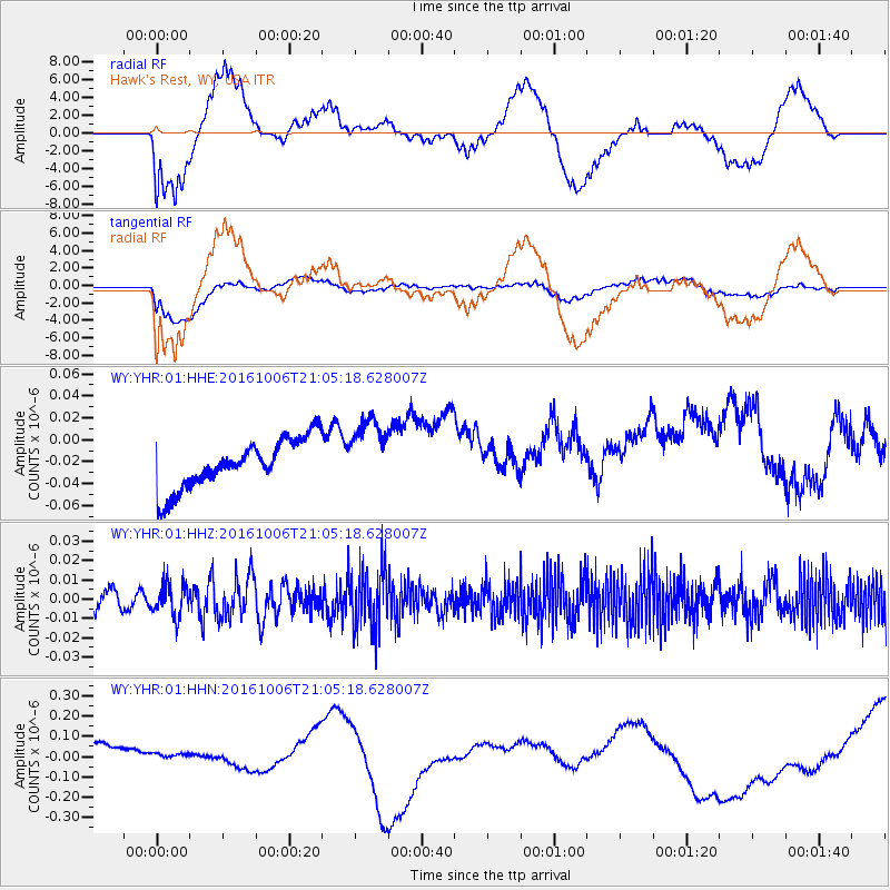
YHR Hawk's Rest, WY, USA - Earthquake Result Viewer
*The percent match for this event was below the threshold and hence no stack was calculated.
| Earthquake location: |
Central East Pacific Rise |
| Earthquake latitude/longitude: |
-4.0/-103.9 |
| Earthquake time(UTC): |
2016/10/06 (280) 20:57:08 GMT |
| Earthquake Depth: |
10 km |
| Earthquake Magnitude: |
5.6 mwb |
| Earthquake Catalog/Contributor: |
NEIC PDE/ |
|
| Network: |
WY Yellowstone Wyoming Seismic Network |
| Station: |
YHR Hawk's Rest, WY, USA |
| Lat/Lon: |
44.11 N/110.08 W |
| Elevation: |
2976 m |
|
| Distance: |
48.2 deg |
| Az: |
354.048 deg |
| Baz: |
171.745 deg |
| Ray Param: |
$rayparam |
*The percent match for this event was below the threshold and hence was not used in the summary stack. |
|
| Radial Match: |
26.790298 % |
| Radial Bump: |
400 |
| Transverse Match: |
35.81348 % |
| Transverse Bump: |
400 |
| SOD ConfigId: |
11737051 |
| Insert Time: |
2019-04-25 17:13:42.344 +0000 |
| GWidth: |
2.5 |
| Max Bumps: |
400 |
| Tol: |
0.001 |
|
Signal To Noise
| Channel | StoN | STA | LTA |
| WY:YHR:01:HHZ:20161006T21:05:18.628007Z | 1.553709 | 8.336358E-9 | 5.3654565E-9 |
| WY:YHR:01:HHN:20161006T21:05:18.628007Z | 0.3774876 | 2.588862E-8 | 6.858137E-8 |
| WY:YHR:01:HHE:20161006T21:05:18.628007Z | 1.4413458 | 3.2072943E-8 | 2.2252081E-8 |
| Arrivals |
| Ps | |
| PpPs | |
| PsPs/PpSs | |


