You are here: Home > Network List > AZ - ANZA Regional Network Stations List
> Station LVA2 AZ.LVA2 > Earthquake Result Viewer
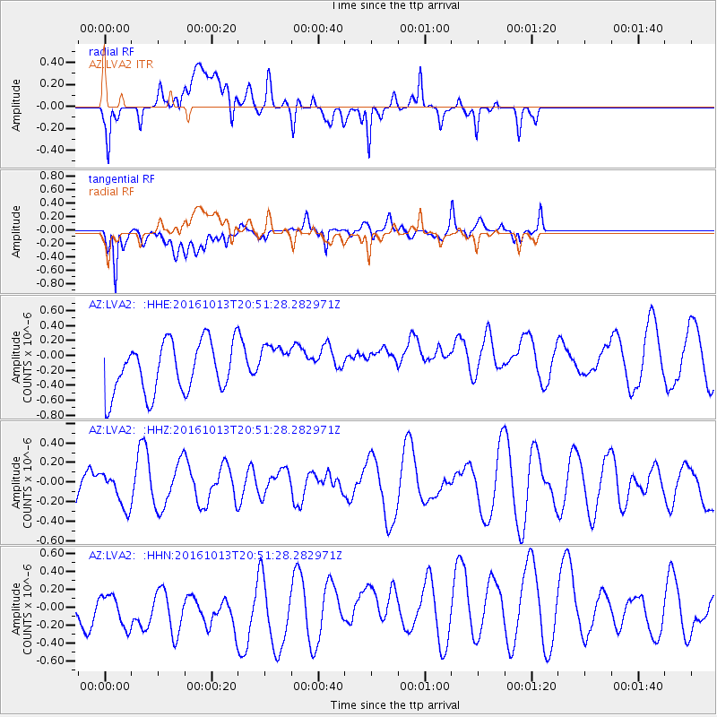
LVA2 AZ.LVA2 - Earthquake Result Viewer
*The percent match for this event was below the threshold and hence no stack was calculated.
| Earthquake location: |
Southeast Of Easter Island |
| Earthquake latitude/longitude: |
-35.5/-104.0 |
| Earthquake time(UTC): |
2016/10/13 (287) 20:40:51 GMT |
| Earthquake Depth: |
10 km |
| Earthquake Magnitude: |
5.0 mb |
| Earthquake Catalog/Contributor: |
NEIC PDE/us |
|
| Network: |
AZ ANZA Regional Network |
| Station: |
LVA2 AZ.LVA2 |
| Lat/Lon: |
33.35 N/116.56 W |
| Elevation: |
1435 m |
|
| Distance: |
69.5 deg |
| Az: |
348.797 deg |
| Baz: |
169.08 deg |
| Ray Param: |
$rayparam |
*The percent match for this event was below the threshold and hence was not used in the summary stack. |
|
| Radial Match: |
52.08634 % |
| Radial Bump: |
400 |
| Transverse Match: |
60.91644 % |
| Transverse Bump: |
400 |
| SOD ConfigId: |
11737051 |
| Insert Time: |
2019-04-25 17:42:19.735 +0000 |
| GWidth: |
2.5 |
| Max Bumps: |
400 |
| Tol: |
0.001 |
|
Signal To Noise
| Channel | StoN | STA | LTA |
| AZ:LVA2: :HHZ:20161013T20:51:28.282971Z | 0.5102444 | 1.7666926E-7 | 3.4624438E-7 |
| AZ:LVA2: :HHN:20161013T20:51:28.282971Z | 1.4615993 | 2.738078E-7 | 1.8733438E-7 |
| AZ:LVA2: :HHE:20161013T20:51:28.282971Z | 0.80661726 | 2.7135E-7 | 3.364049E-7 |
| Arrivals |
| Ps | |
| PpPs | |
| PsPs/PpSs | |


