CMB Columbia College, Columbia, CA - Earthquake Result Viewer
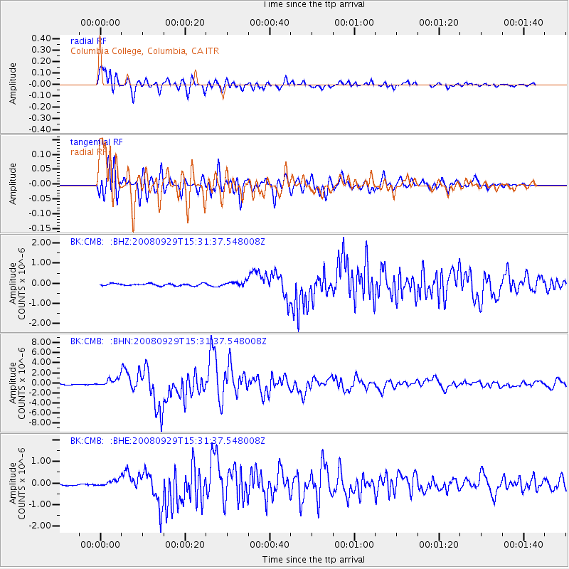
Earthquake location: Kermadec Islands, New Zealand
Earthquake latitude/longitude: -29.8/-177.7
Earthquake time(UTC): 2008/09/29 (273) 15:19:31 GMT
Earthquake Depth: 36 km
Earthquake Magnitude: 6.5 MB, 6.7 MS, 7.0 MW, 7.0 MW
Earthquake Catalog/Contributor: WHDF/NEIC
Network: BK Berkeley Digital Seismograph Network
Station: CMB Columbia College, Columbia, CA
Lat/Lon: 38.03 N/120.39 W
Elevation: 697 m
Distance: 86.1 deg
Az: 41.76 deg
Baz: 227.175 deg
Ray Param: 0.04424337
Estimated Moho Depth: 16.75 km
Estimated Crust Vp/Vs: 1.60
Assumed Crust Vp: 6.597 km/s
Estimated Crust Vs: 4.123 km/s
Estimated Crust Poisson's Ratio: 0.18
Radial Match: 97.09152 %
Radial Bump: 400
Transverse Match: 92.92845 %
Transverse Bump: 400
SOD ConfigId: 2560
Insert Time: 2010-03-05 18:38:06.879 +0000
GWidth: 2.5
Max Bumps: 400
Tol: 0.001

Signal To Noise

ChannelStoNSTALTA
BK:CMB: :BHN:20080929T15:31:37.548008Z11.6485098.485685E-77.284782E-8
BK:CMB: :BHE:20080929T15:31:37.548008Z4.8301861.6054166E-73.3237157E-8
BK:CMB: :BHZ:20080929T15:31:37.548008Z2.2690741.1377074E-75.0139725E-8
Arrivals
Ps1.6 SECOND
PpPs6.4 SECOND
PsPs/PpSs8.0 SECOND