You are here: Home > Network List > TA - USArray Transportable Network (new EarthScope stations) Stations List
> Station H17A Grant Village (NPS), Yellowstone Nt. Park, WY, USA > Earthquake Result Viewer
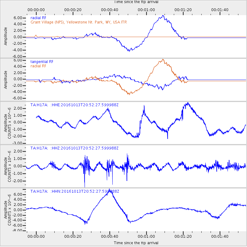
H17A Grant Village (NPS), Yellowstone Nt. Park, WY, USA - Earthquake Result Viewer
*The percent match for this event was below the threshold and hence no stack was calculated.
| Earthquake location: |
Southeast Of Easter Island |
| Earthquake latitude/longitude: |
-35.5/-104.0 |
| Earthquake time(UTC): |
2016/10/13 (287) 20:40:51 GMT |
| Earthquake Depth: |
10 km |
| Earthquake Magnitude: |
5.0 mb |
| Earthquake Catalog/Contributor: |
NEIC PDE/us |
|
| Network: |
TA USArray Transportable Network (new EarthScope stations) |
| Station: |
H17A Grant Village (NPS), Yellowstone Nt. Park, WY, USA |
| Lat/Lon: |
44.40 N/110.58 W |
| Elevation: |
2400 m |
|
| Distance: |
79.7 deg |
| Az: |
355.218 deg |
| Baz: |
174.554 deg |
| Ray Param: |
$rayparam |
*The percent match for this event was below the threshold and hence was not used in the summary stack. |
|
| Radial Match: |
48.24373 % |
| Radial Bump: |
400 |
| Transverse Match: |
21.374365 % |
| Transverse Bump: |
400 |
| SOD ConfigId: |
11737051 |
| Insert Time: |
2019-04-25 17:47:58.518 +0000 |
| GWidth: |
2.5 |
| Max Bumps: |
400 |
| Tol: |
0.001 |
|
Signal To Noise
| Channel | StoN | STA | LTA |
| TA:H17A: :HHZ:20161013T20:52:27.599988Z | 0.99335086 | 2.4408186E-7 | 2.4571565E-7 |
| TA:H17A: :HHN:20161013T20:52:27.599988Z | 3.5889008 | 1.315041E-6 | 3.6641887E-7 |
| TA:H17A: :HHE:20161013T20:52:27.599988Z | 1.4636729 | 6.7317126E-7 | 4.5991922E-7 |
| Arrivals |
| Ps | |
| PpPs | |
| PsPs/PpSs | |


