You are here: Home > Network List > US - United States National Seismic Network Stations List
> Station CBKS Cedar Bluff, Kansas, USA > Earthquake Result Viewer
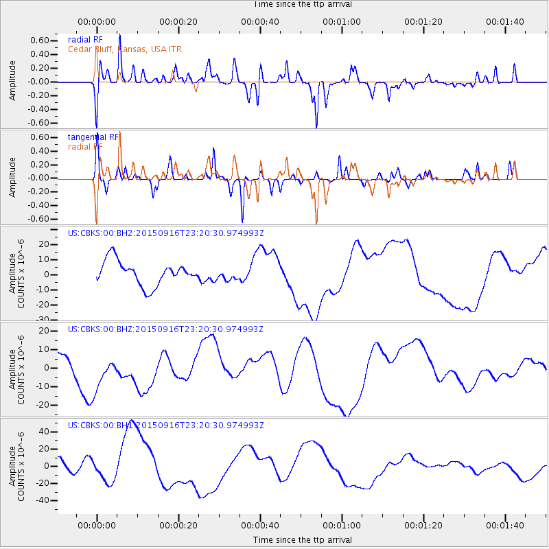
CBKS Cedar Bluff, Kansas, USA - Earthquake Result Viewer
*The percent match for this event was below the threshold and hence no stack was calculated.
| Earthquake location: |
Near Coast Of Central Chile |
| Earthquake latitude/longitude: |
-31.5/-71.7 |
| Earthquake time(UTC): |
2015/09/16 (259) 23:09:22 GMT |
| Earthquake Depth: |
10 km |
| Earthquake Magnitude: |
5.6 MB, 5.9 MB |
| Earthquake Catalog/Contributor: |
NEIC PDE/NEIC COMCAT |
|
| Network: |
US United States National Seismic Network |
| Station: |
CBKS Cedar Bluff, Kansas, USA |
| Lat/Lon: |
38.81 N/99.74 W |
| Elevation: |
677 m |
|
| Distance: |
74.7 deg |
| Az: |
337.598 deg |
| Baz: |
155.375 deg |
| Ray Param: |
$rayparam |
*The percent match for this event was below the threshold and hence was not used in the summary stack. |
|
| Radial Match: |
49.795124 % |
| Radial Bump: |
291 |
| Transverse Match: |
31.87654 % |
| Transverse Bump: |
173 |
| SOD ConfigId: |
1156111 |
| Insert Time: |
2015-10-15 00:56:40.628 +0000 |
| GWidth: |
2.5 |
| Max Bumps: |
400 |
| Tol: |
0.001 |
|
Signal To Noise
| Channel | StoN | STA | LTA |
| US:CBKS:00:BHZ:20150916T23:20:30.974993Z | 1.7402619 | 1.0173725E-5 | 5.8460887E-6 |
| US:CBKS:00:BH1:20150916T23:20:30.974993Z | 1.09646 | 1.25133465E-5 | 1.1412497E-5 |
| US:CBKS:00:BH2:20150916T23:20:30.974993Z | 0.5002406 | 3.9540087E-6 | 7.904213E-6 |
| Arrivals |
| Ps | |
| PpPs | |
| PsPs/PpSs | |


