You are here: Home > Network List > TA - USArray Transportable Network (new EarthScope stations) Stations List
> Station M31M Drury Creek, Yukon, CA > Earthquake Result Viewer
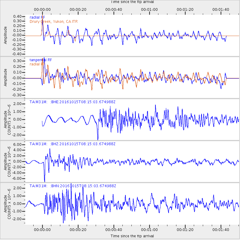
M31M Drury Creek, Yukon, CA - Earthquake Result Viewer
*The percent match for this event was below the threshold and hence no stack was calculated.
| Earthquake location: |
New Britain Region, P.N.G. |
| Earthquake latitude/longitude: |
-4.3/150.4 |
| Earthquake time(UTC): |
2016/10/15 (289) 08:03:39 GMT |
| Earthquake Depth: |
451 km |
| Earthquake Magnitude: |
6.0 MB |
| Earthquake Catalog/Contributor: |
NEIC PDE/NEIC ALERT |
|
| Network: |
TA USArray Transportable Network (new EarthScope stations) |
| Station: |
M31M Drury Creek, Yukon, CA |
| Lat/Lon: |
62.20 N/134.39 W |
| Elevation: |
639 m |
|
| Distance: |
86.9 deg |
| Az: |
26.995 deg |
| Baz: |
254.926 deg |
| Ray Param: |
$rayparam |
*The percent match for this event was below the threshold and hence was not used in the summary stack. |
|
| Radial Match: |
60.400726 % |
| Radial Bump: |
400 |
| Transverse Match: |
71.13198 % |
| Transverse Bump: |
400 |
| SOD ConfigId: |
11737051 |
| Insert Time: |
2019-04-25 18:08:45.494 +0000 |
| GWidth: |
2.5 |
| Max Bumps: |
400 |
| Tol: |
0.001 |
|
Signal To Noise
| Channel | StoN | STA | LTA |
| TA:M31M: :BHZ:20161015T08:15:03.674988Z | 8.255323 | 2.5070879E-6 | 3.036935E-7 |
| TA:M31M: :BHN:20161015T08:15:03.674988Z | 2.599287 | 6.7091986E-7 | 2.5811687E-7 |
| TA:M31M: :BHE:20161015T08:15:03.674988Z | 2.8970232 | 9.145956E-7 | 3.1570187E-7 |
| Arrivals |
| Ps | |
| PpPs | |
| PsPs/PpSs | |


