You are here: Home > Network List > TA - USArray Transportable Network (new EarthScope stations) Stations List
> Station J26L Joseph Creek, AK, USA > Earthquake Result Viewer
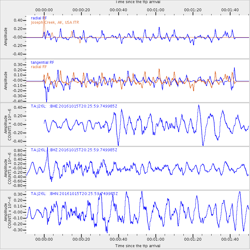
J26L Joseph Creek, AK, USA - Earthquake Result Viewer
*The percent match for this event was below the threshold and hence no stack was calculated.
| Earthquake location: |
Greece-Albania Border Region |
| Earthquake latitude/longitude: |
39.8/20.7 |
| Earthquake time(UTC): |
2016/10/15 (289) 20:14:49 GMT |
| Earthquake Depth: |
22 km |
| Earthquake Magnitude: |
5.5 MWW, 5.3 MWB, 5.5 MWC |
| Earthquake Catalog/Contributor: |
NEIC PDE/NEIC COMCAT |
|
| Network: |
TA USArray Transportable Network (new EarthScope stations) |
| Station: |
J26L Joseph Creek, AK, USA |
| Lat/Lon: |
64.50 N/143.56 W |
| Elevation: |
1144 m |
|
| Distance: |
75.3 deg |
| Az: |
353.01 deg |
| Baz: |
12.507 deg |
| Ray Param: |
$rayparam |
*The percent match for this event was below the threshold and hence was not used in the summary stack. |
|
| Radial Match: |
58.195423 % |
| Radial Bump: |
400 |
| Transverse Match: |
57.668083 % |
| Transverse Bump: |
400 |
| SOD ConfigId: |
11737051 |
| Insert Time: |
2019-04-25 18:32:12.508 +0000 |
| GWidth: |
2.5 |
| Max Bumps: |
400 |
| Tol: |
0.001 |
|
Signal To Noise
| Channel | StoN | STA | LTA |
| TA:J26L: :BHZ:20161015T20:25:59.749985Z | 2.869653 | 3.81568E-7 | 1.3296659E-7 |
| TA:J26L: :BHN:20161015T20:25:59.749985Z | 0.77721554 | 8.174879E-8 | 1.0518161E-7 |
| TA:J26L: :BHE:20161015T20:25:59.749985Z | 0.74830997 | 6.3253374E-8 | 8.452831E-8 |
| Arrivals |
| Ps | |
| PpPs | |
| PsPs/PpSs | |


