CMB Columbia College, California, USA - Earthquake Result Viewer
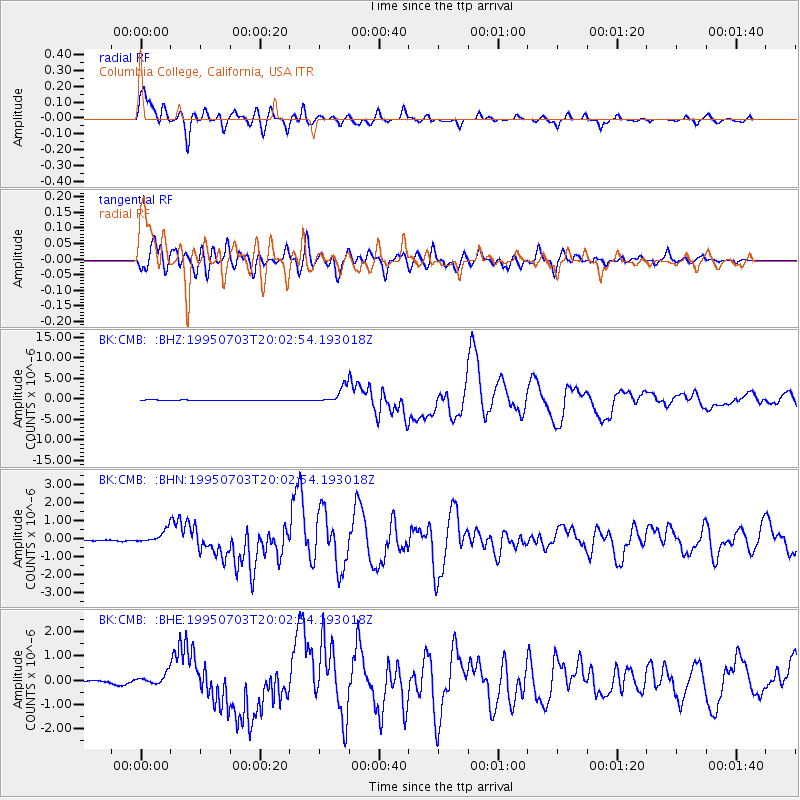
Earthquake location: Kermadec Islands, New Zealand
Earthquake latitude/longitude: -29.2/-177.6
Earthquake time(UTC): 1995/07/03 (184) 19:50:50 GMT
Earthquake Depth: 33 km
Earthquake Magnitude: 6.5 MB, 7.2 MS, 7.2 UNKNOWN, 7.2 MW
Earthquake Catalog/Contributor: WHDF/NEIC
Network: BK Berkeley Digital Seismograph Network
Station: CMB Columbia College, California, USA
Lat/Lon: 38.03 N/120.39 W
Elevation: 719 m
Distance: 85.6 deg
Az: 41.749 deg
Baz: 227.5 deg
Ray Param: 0.044572864
Estimated Moho Depth: 16.75 km
Estimated Crust Vp/Vs: 1.60
Assumed Crust Vp: 6.597 km/s
Estimated Crust Vs: 4.123 km/s
Estimated Crust Poisson's Ratio: 0.18
Radial Match: 97.364655 %
Radial Bump: 400
Transverse Match: 90.92105 %
Transverse Bump: 400
SOD ConfigId: 6273
Insert Time: 2010-03-05 18:42:59.792 +0000
GWidth: 2.5
Max Bumps: 400
Tol: 0.001

Signal To Noise

ChannelStoNSTALTA
BK:CMB: :BHN:19950703T20:02:54.193018Z7.10190733.8746356E-75.4557677E-8
BK:CMB: :BHE:19950703T20:02:54.193018Z3.54149992.413025E-76.8135684E-8
BK:CMB: :BHZ:19950703T20:02:54.193018Z32.093781.988422E-66.195661E-8
Arrivals
Ps1.6 SECOND
PpPs6.4 SECOND
PsPs/PpSs8.0 SECOND