You are here: Home > Network List > AK - Alaska Regional Network Stations List
> Station GAMB Gambell Broadband > Earthquake Result Viewer
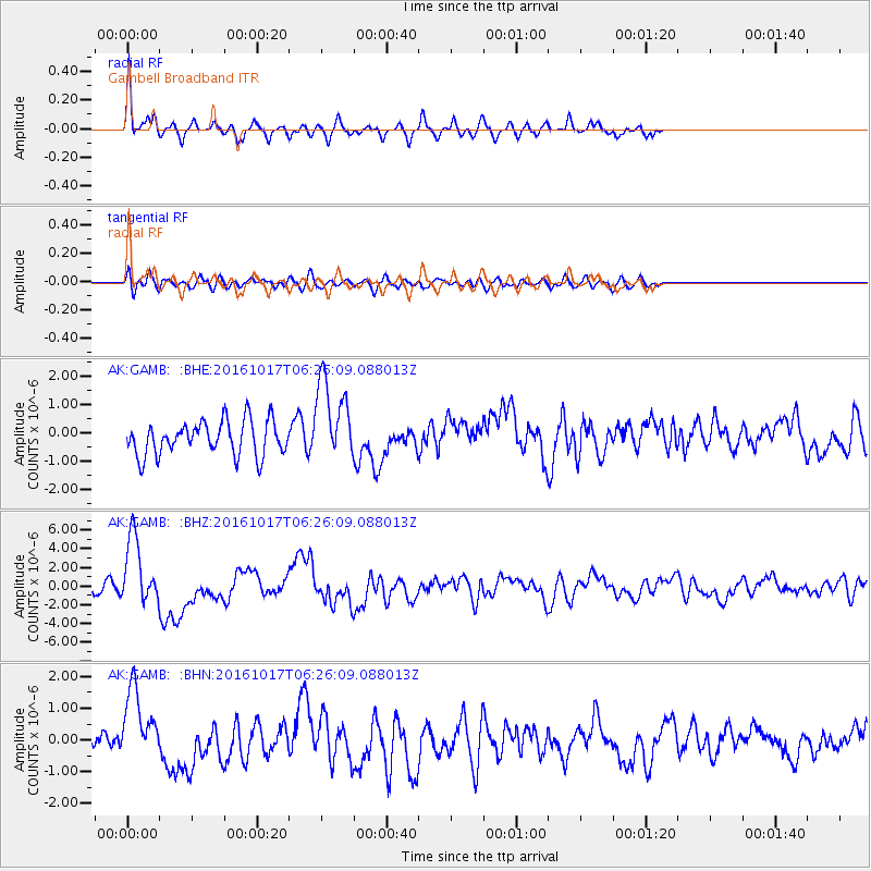
GAMB Gambell Broadband - Earthquake Result Viewer
*The percent match for this event was below the threshold and hence no stack was calculated.
| Earthquake location: |
New Britain Region, P.N.G. |
| Earthquake latitude/longitude: |
-6.1/148.9 |
| Earthquake time(UTC): |
2016/10/17 (291) 06:14:58 GMT |
| Earthquake Depth: |
35 km |
| Earthquake Magnitude: |
6.9 MO |
| Earthquake Catalog/Contributor: |
NEIC PDE/NEIC ALERT |
|
| Network: |
AK Alaska Regional Network |
| Station: |
GAMB Gambell Broadband |
| Lat/Lon: |
63.78 N/171.70 W |
| Elevation: |
10 m |
|
| Distance: |
75.7 deg |
| Az: |
16.934 deg |
| Baz: |
220.693 deg |
| Ray Param: |
$rayparam |
*The percent match for this event was below the threshold and hence was not used in the summary stack. |
|
| Radial Match: |
79.16937 % |
| Radial Bump: |
376 |
| Transverse Match: |
61.824257 % |
| Transverse Bump: |
400 |
| SOD ConfigId: |
11737051 |
| Insert Time: |
2019-04-25 18:40:41.734 +0000 |
| GWidth: |
2.5 |
| Max Bumps: |
400 |
| Tol: |
0.001 |
|
Signal To Noise
| Channel | StoN | STA | LTA |
| AK:GAMB: :BHZ:20161017T06:26:09.088013Z | 8.310958 | 3.6375782E-6 | 4.3768455E-7 |
| AK:GAMB: :BHN:20161017T06:26:09.088013Z | 3.2558687 | 1.2221169E-6 | 3.7535816E-7 |
| AK:GAMB: :BHE:20161017T06:26:09.088013Z | 2.4341974 | 1.4888806E-6 | 6.116515E-7 |
| Arrivals |
| Ps | |
| PpPs | |
| PsPs/PpSs | |


