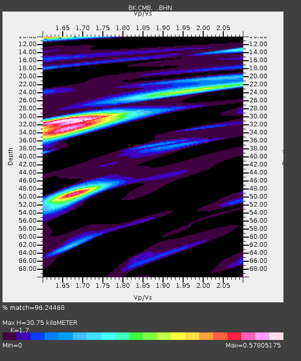
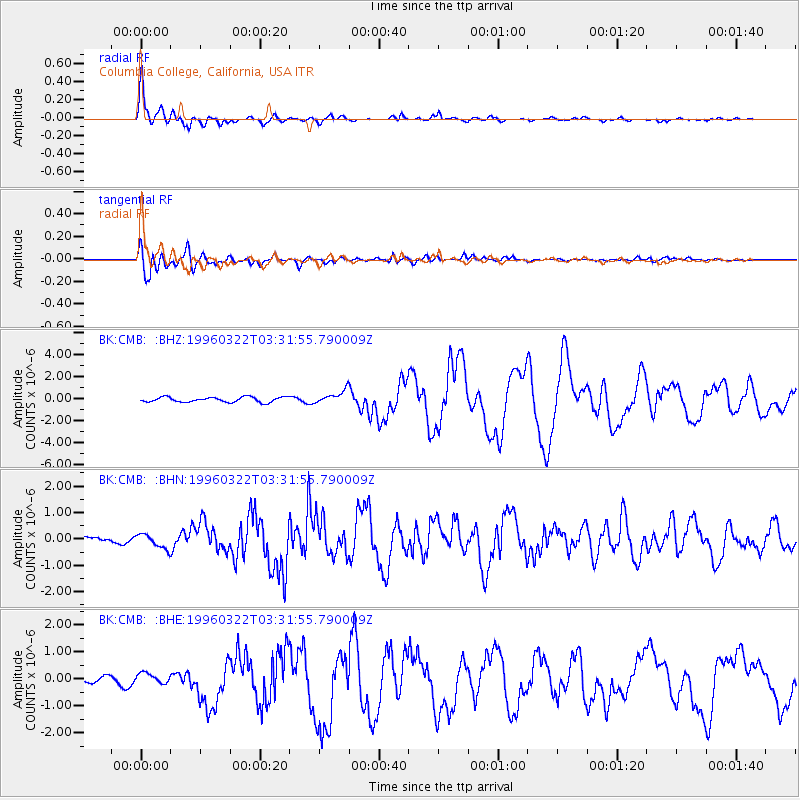
CMB Columbia College, California, USA - Earthquake Result Viewer

Earthquake location: Rat Islands, Aleutian Islands
Earthquake latitude/longitude: 51.2/178.7
Earthquake time(UTC): 1996/03/22 (082) 03:24:20 GMT
Earthquake Depth: 20 km
Earthquake Magnitude: 5.7 MB, 6.6 MS, 6.8 UNKNOWN, 6.6 ML
Earthquake Catalog/Contributor: WHDF/NEIC
Network: BK Berkeley Digital Seismograph Network
Station: CMB Columbia College, California, USA
Lat/Lon: 38.03 N/120.39 W
Elevation: 719 m
Distance: 44.1 deg
Az: 82.777 deg
Baz: 307.806 deg
Ray Param: 0.07211348
Estimated Moho Depth: 30.75 km
Estimated Crust Vp/Vs: 1.70
Assumed Crust Vp: 6.597 km/s
Estimated Crust Vs: 3.881 km/s
Estimated Crust Poisson's Ratio: 0.24
Radial Match: 96.24468 %
Radial Bump: 400
Transverse Match: 88.59886 %
Transverse Bump: 400
SOD ConfigId: 6273
Insert Time: 2010-03-05 18:44:13.897 +0000
GWidth: 2.5
Max Bumps: 400
Tol: 0.001

Signal To Noise

ChannelStoNSTALTA
BK:CMB: :BHN:19960322T03:31:55.790009Z3.8207682.7865858E-77.29326E-8
BK:CMB: :BHE:19960322T03:31:55.790009Z1.24701152.0031958E-71.6063971E-7
BK:CMB: :BHZ:19960322T03:31:55.790009Z2.52413375.703578E-72.2596183E-7
Arrivals
Ps3.5 SECOND
PpPs12 SECOND
PsPs/PpSs15 SECOND