You are here: Home > Network List > TA - USArray Transportable Network (new EarthScope stations) Stations List
> Station V35K Ketchikan, AK, USA > Earthquake Result Viewer
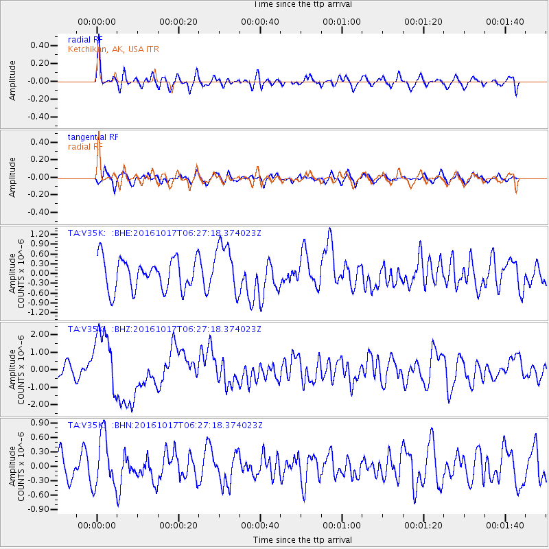
V35K Ketchikan, AK, USA - Earthquake Result Viewer
*The percent match for this event was below the threshold and hence no stack was calculated.
| Earthquake location: |
New Britain Region, P.N.G. |
| Earthquake latitude/longitude: |
-6.1/148.9 |
| Earthquake time(UTC): |
2016/10/17 (291) 06:14:58 GMT |
| Earthquake Depth: |
35 km |
| Earthquake Magnitude: |
6.9 MO |
| Earthquake Catalog/Contributor: |
NEIC PDE/NEIC ALERT |
|
| Network: |
TA USArray Transportable Network (new EarthScope stations) |
| Station: |
V35K Ketchikan, AK, USA |
| Lat/Lon: |
55.33 N/131.62 W |
| Elevation: |
64 m |
|
| Distance: |
89.0 deg |
| Az: |
34.196 deg |
| Baz: |
257.978 deg |
| Ray Param: |
$rayparam |
*The percent match for this event was below the threshold and hence was not used in the summary stack. |
|
| Radial Match: |
69.5596 % |
| Radial Bump: |
400 |
| Transverse Match: |
51.253883 % |
| Transverse Bump: |
400 |
| SOD ConfigId: |
11737051 |
| Insert Time: |
2019-04-25 18:52:06.231 +0000 |
| GWidth: |
2.5 |
| Max Bumps: |
400 |
| Tol: |
0.001 |
|
Signal To Noise
| Channel | StoN | STA | LTA |
| TA:V35K: :BHZ:20161017T06:27:18.374023Z | 3.7854664 | 1.8366927E-6 | 4.8519587E-7 |
| TA:V35K: :BHN:20161017T06:27:18.374023Z | 1.3910332 | 5.5352484E-7 | 3.9792351E-7 |
| TA:V35K: :BHE:20161017T06:27:18.374023Z | 1.6526791 | 7.808533E-7 | 4.7247727E-7 |
| Arrivals |
| Ps | |
| PpPs | |
| PsPs/PpSs | |


