You are here: Home > Network List > UW - Pacific Northwest Regional Seismic Network Stations List
> Station MRBL Marblemount, WA, USA > Earthquake Result Viewer
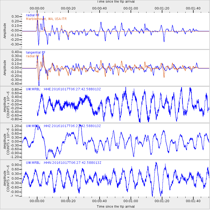
MRBL Marblemount, WA, USA - Earthquake Result Viewer
*The percent match for this event was below the threshold and hence no stack was calculated.
| Earthquake location: |
New Britain Region, P.N.G. |
| Earthquake latitude/longitude: |
-6.1/148.9 |
| Earthquake time(UTC): |
2016/10/17 (291) 06:14:58 GMT |
| Earthquake Depth: |
35 km |
| Earthquake Magnitude: |
6.9 MO |
| Earthquake Catalog/Contributor: |
NEIC PDE/NEIC ALERT |
|
| Network: |
UW Pacific Northwest Regional Seismic Network |
| Station: |
MRBL Marblemount, WA, USA |
| Lat/Lon: |
48.52 N/121.48 W |
| Elevation: |
75 m |
|
| Distance: |
94.3 deg |
| Az: |
41.813 deg |
| Baz: |
265.737 deg |
| Ray Param: |
$rayparam |
*The percent match for this event was below the threshold and hence was not used in the summary stack. |
|
| Radial Match: |
56.407066 % |
| Radial Bump: |
400 |
| Transverse Match: |
64.121796 % |
| Transverse Bump: |
400 |
| SOD ConfigId: |
11737051 |
| Insert Time: |
2019-04-25 18:53:04.519 +0000 |
| GWidth: |
2.5 |
| Max Bumps: |
400 |
| Tol: |
0.001 |
|
Signal To Noise
| Channel | StoN | STA | LTA |
| UW:MRBL: :HHZ:20161017T06:27:42.588013Z | 4.934156 | 9.080471E-7 | 1.8403293E-7 |
| UW:MRBL: :HHN:20161017T06:27:42.588013Z | 1.7404798 | 3.5703448E-7 | 2.0513568E-7 |
| UW:MRBL: :HHE:20161017T06:27:42.588013Z | 1.4104217 | 3.246187E-7 | 2.301572E-7 |
| Arrivals |
| Ps | |
| PpPs | |
| PsPs/PpSs | |


