You are here: Home > Network List > UW - Pacific Northwest Regional Seismic Network Stations List
> Station LTY Liberty (broad-band) > Earthquake Result Viewer
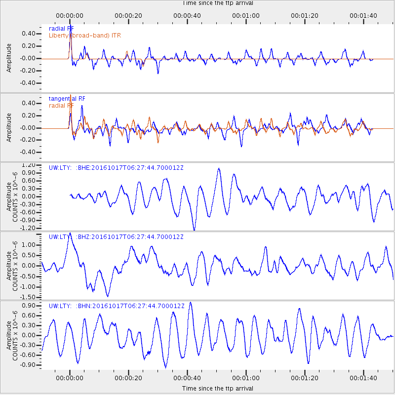
LTY Liberty (broad-band) - Earthquake Result Viewer
*The percent match for this event was below the threshold and hence no stack was calculated.
| Earthquake location: |
New Britain Region, P.N.G. |
| Earthquake latitude/longitude: |
-6.1/148.9 |
| Earthquake time(UTC): |
2016/10/17 (291) 06:14:58 GMT |
| Earthquake Depth: |
35 km |
| Earthquake Magnitude: |
6.9 MO |
| Earthquake Catalog/Contributor: |
NEIC PDE/NEIC ALERT |
|
| Network: |
UW Pacific Northwest Regional Seismic Network |
| Station: |
LTY Liberty (broad-band) |
| Lat/Lon: |
47.26 N/120.66 W |
| Elevation: |
970 m |
|
| Distance: |
94.7 deg |
| Az: |
43.116 deg |
| Baz: |
266.241 deg |
| Ray Param: |
$rayparam |
*The percent match for this event was below the threshold and hence was not used in the summary stack. |
|
| Radial Match: |
64.94038 % |
| Radial Bump: |
400 |
| Transverse Match: |
56.225117 % |
| Transverse Bump: |
399 |
| SOD ConfigId: |
11737051 |
| Insert Time: |
2019-04-25 18:53:04.661 +0000 |
| GWidth: |
2.5 |
| Max Bumps: |
400 |
| Tol: |
0.001 |
|
Signal To Noise
| Channel | StoN | STA | LTA |
| UW:LTY: :BHZ:20161017T06:27:44.700012Z | 6.9160805 | 9.3116046E-7 | 1.3463702E-7 |
| UW:LTY: :BHN:20161017T06:27:44.700012Z | 1.3444972 | 4.9454394E-7 | 3.6782816E-7 |
| UW:LTY: :BHE:20161017T06:27:44.700012Z | 1.7704719 | 4.2586086E-7 | 2.4053523E-7 |
| Arrivals |
| Ps | |
| PpPs | |
| PsPs/PpSs | |


