You are here: Home > Network List > UW - Pacific Northwest Regional Seismic Network Stations List
> Station UMAT Pilot Rock, OR, USA > Earthquake Result Viewer
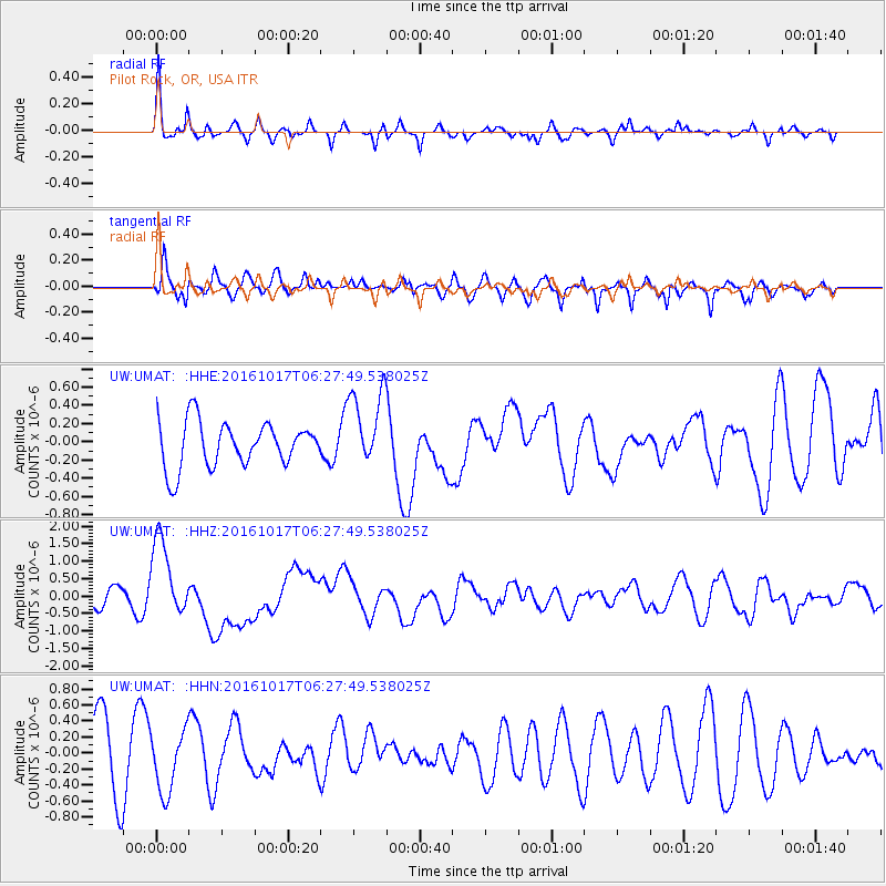
UMAT Pilot Rock, OR, USA - Earthquake Result Viewer
*The percent match for this event was below the threshold and hence no stack was calculated.
| Earthquake location: |
New Britain Region, P.N.G. |
| Earthquake latitude/longitude: |
-6.1/148.9 |
| Earthquake time(UTC): |
2016/10/17 (291) 06:14:58 GMT |
| Earthquake Depth: |
35 km |
| Earthquake Magnitude: |
6.9 MO |
| Earthquake Catalog/Contributor: |
NEIC PDE/NEIC ALERT |
|
| Network: |
UW Pacific Northwest Regional Seismic Network |
| Station: |
UMAT Pilot Rock, OR, USA |
| Lat/Lon: |
45.29 N/118.96 W |
| Elevation: |
1318 m |
|
| Distance: |
95.8 deg |
| Az: |
45.154 deg |
| Baz: |
267.283 deg |
| Ray Param: |
$rayparam |
*The percent match for this event was below the threshold and hence was not used in the summary stack. |
|
| Radial Match: |
74.4382 % |
| Radial Bump: |
390 |
| Transverse Match: |
61.482365 % |
| Transverse Bump: |
400 |
| SOD ConfigId: |
11737051 |
| Insert Time: |
2019-04-25 18:53:10.707 +0000 |
| GWidth: |
2.5 |
| Max Bumps: |
400 |
| Tol: |
0.001 |
|
Signal To Noise
| Channel | StoN | STA | LTA |
| UW:UMAT: :HHZ:20161017T06:27:49.538025Z | 3.0536206 | 1.1460966E-6 | 3.7532385E-7 |
| UW:UMAT: :HHN:20161017T06:27:49.538025Z | 0.90652424 | 3.8529174E-7 | 4.250209E-7 |
| UW:UMAT: :HHE:20161017T06:27:49.538025Z | 1.6445255 | 4.1100455E-7 | 2.499229E-7 |
| Arrivals |
| Ps | |
| PpPs | |
| PsPs/PpSs | |


