You are here: Home > Network List > CN - Canadian National Seismograph Network Stations List
> Station INK INUVIK, NT > Earthquake Result Viewer
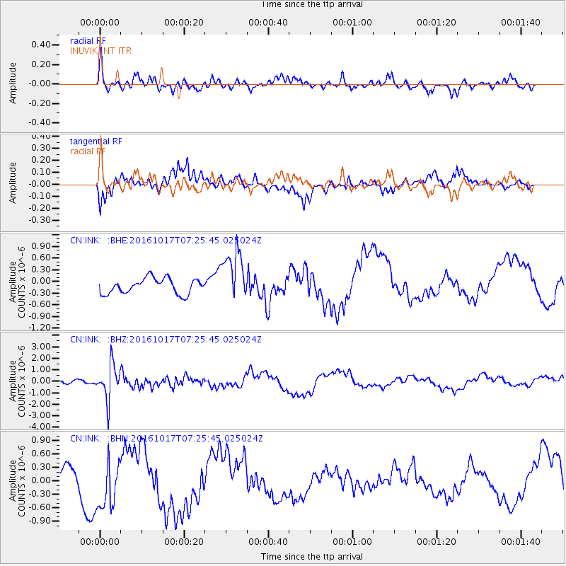
INK INUVIK, NT - Earthquake Result Viewer
*The percent match for this event was below the threshold and hence no stack was calculated.
| Earthquake location: |
Xizang |
| Earthquake latitude/longitude: |
32.9/94.9 |
| Earthquake time(UTC): |
2016/10/17 (291) 07:14:50 GMT |
| Earthquake Depth: |
32 km |
| Earthquake Magnitude: |
6.4 MO |
| Earthquake Catalog/Contributor: |
NEIC PDE/NEIC ALERT |
|
| Network: |
CN Canadian National Seismograph Network |
| Station: |
INK INUVIK, NT |
| Lat/Lon: |
68.31 N/133.53 W |
| Elevation: |
44 m |
|
| Distance: |
72.9 deg |
| Az: |
16.912 deg |
| Baz: |
318.84 deg |
| Ray Param: |
$rayparam |
*The percent match for this event was below the threshold and hence was not used in the summary stack. |
|
| Radial Match: |
36.319687 % |
| Radial Bump: |
324 |
| Transverse Match: |
65.939896 % |
| Transverse Bump: |
393 |
| SOD ConfigId: |
11737051 |
| Insert Time: |
2019-04-25 19:04:07.070 +0000 |
| GWidth: |
2.5 |
| Max Bumps: |
400 |
| Tol: |
0.001 |
|
Signal To Noise
| Channel | StoN | STA | LTA |
| CN:INK: :BHZ:20161017T07:25:45.025024Z | 8.672459 | 1.5412234E-6 | 1.777147E-7 |
| CN:INK: :BHN:20161017T07:25:45.025024Z | 2.7163746 | 5.477827E-7 | 2.0165947E-7 |
| CN:INK: :BHE:20161017T07:25:45.025024Z | 3.4262633 | 6.7399486E-7 | 1.9671425E-7 |
| Arrivals |
| Ps | |
| PpPs | |
| PsPs/PpSs | |


