You are here: Home > Network List > TA - USArray Transportable Network (new EarthScope stations) Stations List
> Station O18K Koktuh Hills, AK, USA > Earthquake Result Viewer
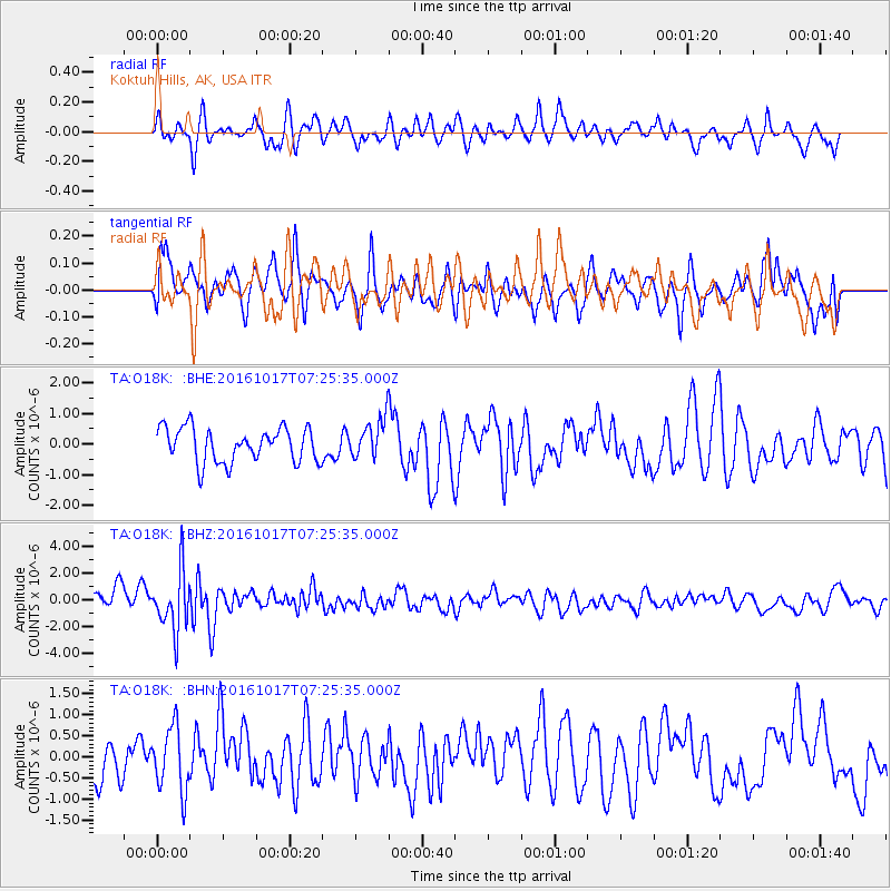
O18K Koktuh Hills, AK, USA - Earthquake Result Viewer
*The percent match for this event was below the threshold and hence no stack was calculated.
| Earthquake location: |
Xizang |
| Earthquake latitude/longitude: |
32.9/94.9 |
| Earthquake time(UTC): |
2016/10/17 (291) 07:14:50 GMT |
| Earthquake Depth: |
32 km |
| Earthquake Magnitude: |
6.4 MO |
| Earthquake Catalog/Contributor: |
NEIC PDE/NEIC ALERT |
|
| Network: |
TA USArray Transportable Network (new EarthScope stations) |
| Station: |
O18K Koktuh Hills, AK, USA |
| Lat/Lon: |
59.85 N/155.21 W |
| Elevation: |
544 m |
|
| Distance: |
71.2 deg |
| Az: |
30.083 deg |
| Baz: |
303.343 deg |
| Ray Param: |
$rayparam |
*The percent match for this event was below the threshold and hence was not used in the summary stack. |
|
| Radial Match: |
59.36777 % |
| Radial Bump: |
373 |
| Transverse Match: |
66.944374 % |
| Transverse Bump: |
400 |
| SOD ConfigId: |
11737051 |
| Insert Time: |
2019-04-25 19:12:39.074 +0000 |
| GWidth: |
2.5 |
| Max Bumps: |
400 |
| Tol: |
0.001 |
|
Signal To Noise
| Channel | StoN | STA | LTA |
| TA:O18K: :BHZ:20161017T07:25:35.000Z | 2.3736525 | 2.1989722E-6 | 9.264087E-7 |
| TA:O18K: :BHN:20161017T07:25:35.000Z | 1.4048766 | 7.623126E-7 | 5.426189E-7 |
| TA:O18K: :BHE:20161017T07:25:35.000Z | 1.0274086 | 5.720833E-7 | 5.568216E-7 |
| Arrivals |
| Ps | |
| PpPs | |
| PsPs/PpSs | |


