You are here: Home > Network List > TA - USArray Transportable Network (new EarthScope stations) Stations List
> Station R33M Jennings River, BC, CAN > Earthquake Result Viewer
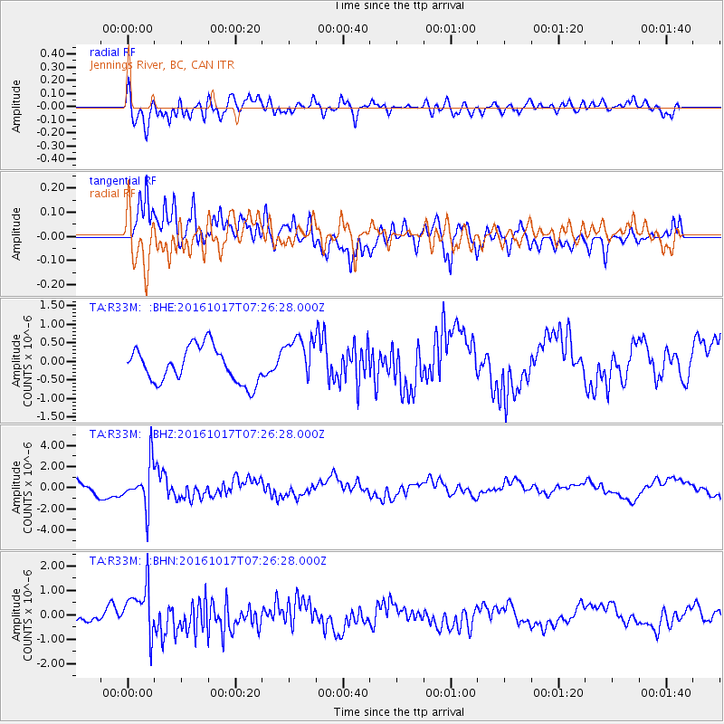
R33M Jennings River, BC, CAN - Earthquake Result Viewer
*The percent match for this event was below the threshold and hence no stack was calculated.
| Earthquake location: |
Xizang |
| Earthquake latitude/longitude: |
32.9/94.9 |
| Earthquake time(UTC): |
2016/10/17 (291) 07:14:50 GMT |
| Earthquake Depth: |
32 km |
| Earthquake Magnitude: |
6.4 MO |
| Earthquake Catalog/Contributor: |
NEIC PDE/NEIC ALERT |
|
| Network: |
TA USArray Transportable Network (new EarthScope stations) |
| Station: |
R33M Jennings River, BC, CAN |
| Lat/Lon: |
59.39 N/130.97 W |
| Elevation: |
1437 m |
|
| Distance: |
80.5 deg |
| Az: |
21.848 deg |
| Baz: |
322.279 deg |
| Ray Param: |
$rayparam |
*The percent match for this event was below the threshold and hence was not used in the summary stack. |
|
| Radial Match: |
69.540344 % |
| Radial Bump: |
400 |
| Transverse Match: |
74.73566 % |
| Transverse Bump: |
400 |
| SOD ConfigId: |
11737051 |
| Insert Time: |
2019-04-25 19:12:59.188 +0000 |
| GWidth: |
2.5 |
| Max Bumps: |
400 |
| Tol: |
0.001 |
|
Signal To Noise
| Channel | StoN | STA | LTA |
| TA:R33M: :BHZ:20161017T07:26:28.000Z | 2.333488 | 2.0467253E-6 | 8.7710987E-7 |
| TA:R33M: :BHN:20161017T07:26:28.000Z | 6.291576 | 1.0299892E-6 | 1.6370926E-7 |
| TA:R33M: :BHE:20161017T07:26:28.000Z | 1.2845342 | 6.097817E-7 | 4.7471033E-7 |
| Arrivals |
| Ps | |
| PpPs | |
| PsPs/PpSs | |


