You are here: Home > Network List > AV - Alaska Volcano Observatory Stations List
> Station AMKA Regional Station, Amchitka Island, Alaska > Earthquake Result Viewer
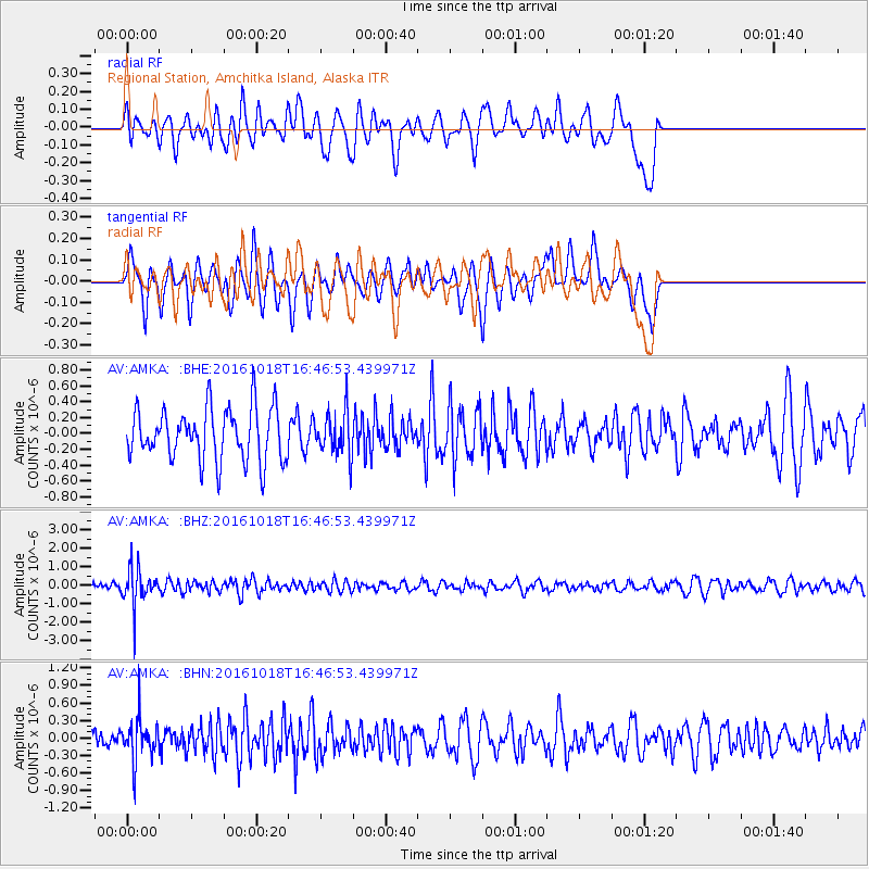
AMKA Regional Station, Amchitka Island, Alaska - Earthquake Result Viewer
*The percent match for this event was below the threshold and hence no stack was calculated.
| Earthquake location: |
South Of Fiji Islands |
| Earthquake latitude/longitude: |
-23.3/-179.9 |
| Earthquake time(UTC): |
2016/10/18 (292) 16:36:41 GMT |
| Earthquake Depth: |
540 km |
| Earthquake Magnitude: |
5.9 MWW, 6.0 MWB |
| Earthquake Catalog/Contributor: |
NEIC PDE/NEIC COMCAT |
|
| Network: |
AV Alaska Volcano Observatory |
| Station: |
AMKA Regional Station, Amchitka Island, Alaska |
| Lat/Lon: |
51.38 N/179.30 E |
| Elevation: |
116 m |
|
| Distance: |
74.4 deg |
| Az: |
359.492 deg |
| Baz: |
179.255 deg |
| Ray Param: |
$rayparam |
*The percent match for this event was below the threshold and hence was not used in the summary stack. |
|
| Radial Match: |
69.78449 % |
| Radial Bump: |
400 |
| Transverse Match: |
52.13761 % |
| Transverse Bump: |
365 |
| SOD ConfigId: |
11737051 |
| Insert Time: |
2019-04-25 19:21:15.968 +0000 |
| GWidth: |
2.5 |
| Max Bumps: |
400 |
| Tol: |
0.001 |
|
Signal To Noise
| Channel | StoN | STA | LTA |
| AV:AMKA: :BHZ:20161018T16:46:53.439971Z | 4.2472825 | 9.861025E-7 | 2.3217254E-7 |
| AV:AMKA: :BHN:20161018T16:46:53.439971Z | 1.6638169 | 3.6207615E-7 | 2.1761778E-7 |
| AV:AMKA: :BHE:20161018T16:46:53.439971Z | 0.8336608 | 2.737179E-7 | 3.2833245E-7 |
| Arrivals |
| Ps | |
| PpPs | |
| PsPs/PpSs | |


