You are here: Home > Network List > TA - USArray Transportable Network (new EarthScope stations) Stations List
> Station 833A Chaparral WMA, Artesia Wells, TX, USA > Earthquake Result Viewer
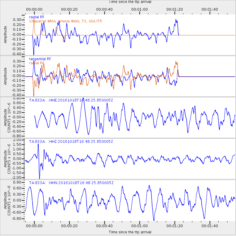
833A Chaparral WMA, Artesia Wells, TX, USA - Earthquake Result Viewer
*The percent match for this event was below the threshold and hence no stack was calculated.
| Earthquake location: |
South Of Fiji Islands |
| Earthquake latitude/longitude: |
-23.3/-179.9 |
| Earthquake time(UTC): |
2016/10/18 (292) 16:36:41 GMT |
| Earthquake Depth: |
540 km |
| Earthquake Magnitude: |
5.9 MWW, 6.0 MWB |
| Earthquake Catalog/Contributor: |
NEIC PDE/NEIC COMCAT |
|
| Network: |
TA USArray Transportable Network (new EarthScope stations) |
| Station: |
833A Chaparral WMA, Artesia Wells, TX, USA |
| Lat/Lon: |
28.32 N/99.39 W |
| Elevation: |
171 m |
|
| Distance: |
93.0 deg |
| Az: |
60.548 deg |
| Baz: |
245.227 deg |
| Ray Param: |
$rayparam |
*The percent match for this event was below the threshold and hence was not used in the summary stack. |
|
| Radial Match: |
51.168396 % |
| Radial Bump: |
400 |
| Transverse Match: |
50.838417 % |
| Transverse Bump: |
357 |
| SOD ConfigId: |
11737051 |
| Insert Time: |
2019-04-25 19:31:06.821 +0000 |
| GWidth: |
2.5 |
| Max Bumps: |
400 |
| Tol: |
0.001 |
|
Signal To Noise
| Channel | StoN | STA | LTA |
| TA:833A: :HHZ:20161018T16:48:25.850005Z | 5.862592 | 8.531892E-7 | 1.4553105E-7 |
| TA:833A: :HHN:20161018T16:48:25.850005Z | 1.5520725 | 4.7690696E-7 | 3.0727105E-7 |
| TA:833A: :HHE:20161018T16:48:25.850005Z | 1.4924462 | 4.2234586E-7 | 2.82989E-7 |
| Arrivals |
| Ps | |
| PpPs | |
| PsPs/PpSs | |


