You are here: Home > Network List > TA - USArray Transportable Network (new EarthScope stations) Stations List
> Station F21K Alatna River, AK, USA > Earthquake Result Viewer
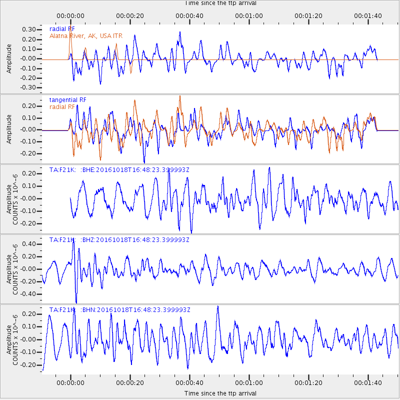
F21K Alatna River, AK, USA - Earthquake Result Viewer
*The percent match for this event was below the threshold and hence no stack was calculated.
| Earthquake location: |
South Of Fiji Islands |
| Earthquake latitude/longitude: |
-23.3/-179.9 |
| Earthquake time(UTC): |
2016/10/18 (292) 16:36:41 GMT |
| Earthquake Depth: |
540 km |
| Earthquake Magnitude: |
5.9 MWW, 6.0 MWB |
| Earthquake Catalog/Contributor: |
NEIC PDE/NEIC COMCAT |
|
| Network: |
TA USArray Transportable Network (new EarthScope stations) |
| Station: |
F21K Alatna River, AK, USA |
| Lat/Lon: |
67.22 N/153.48 W |
| Elevation: |
597 m |
|
| Distance: |
92.4 deg |
| Az: |
9.991 deg |
| Baz: |
204.18 deg |
| Ray Param: |
$rayparam |
*The percent match for this event was below the threshold and hence was not used in the summary stack. |
|
| Radial Match: |
42.819584 % |
| Radial Bump: |
400 |
| Transverse Match: |
54.48041 % |
| Transverse Bump: |
400 |
| SOD ConfigId: |
11737051 |
| Insert Time: |
2019-04-25 19:31:20.602 +0000 |
| GWidth: |
2.5 |
| Max Bumps: |
400 |
| Tol: |
0.001 |
|
Signal To Noise
| Channel | StoN | STA | LTA |
| TA:F21K: :BHZ:20161018T16:48:23.399993Z | 2.3827753 | 2.4829447E-7 | 1.0420389E-7 |
| TA:F21K: :BHN:20161018T16:48:23.399993Z | 1.1981844 | 1.1982108E-7 | 1.0000221E-7 |
| TA:F21K: :BHE:20161018T16:48:23.399993Z | 1.2651287 | 1.0533354E-7 | 8.325915E-8 |
| Arrivals |
| Ps | |
| PpPs | |
| PsPs/PpSs | |


