You are here: Home > Network List > TA - USArray Transportable Network (new EarthScope stations) Stations List
> Station J25K Salcha River, AK, USA > Earthquake Result Viewer
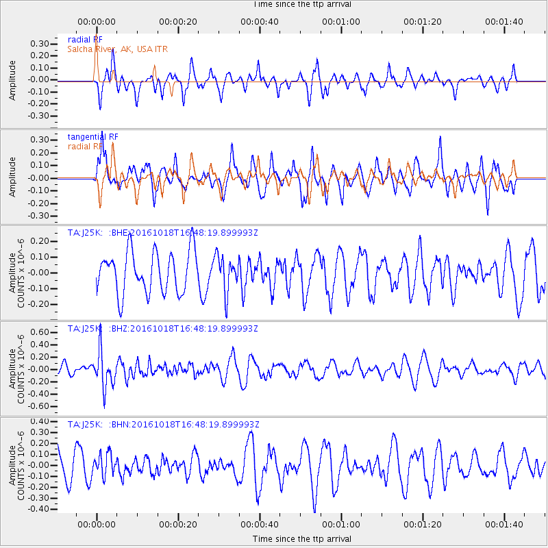
J25K Salcha River, AK, USA - Earthquake Result Viewer
*The percent match for this event was below the threshold and hence no stack was calculated.
| Earthquake location: |
South Of Fiji Islands |
| Earthquake latitude/longitude: |
-23.3/-179.9 |
| Earthquake time(UTC): |
2016/10/18 (292) 16:36:41 GMT |
| Earthquake Depth: |
540 km |
| Earthquake Magnitude: |
5.9 MWW, 6.0 MWB |
| Earthquake Catalog/Contributor: |
NEIC PDE/NEIC COMCAT |
|
| Network: |
TA USArray Transportable Network (new EarthScope stations) |
| Station: |
J25K Salcha River, AK, USA |
| Lat/Lon: |
64.61 N/145.37 W |
| Elevation: |
949 m |
|
| Distance: |
91.6 deg |
| Az: |
14.156 deg |
| Baz: |
211.435 deg |
| Ray Param: |
$rayparam |
*The percent match for this event was below the threshold and hence was not used in the summary stack. |
|
| Radial Match: |
49.716007 % |
| Radial Bump: |
339 |
| Transverse Match: |
63.277775 % |
| Transverse Bump: |
400 |
| SOD ConfigId: |
11737051 |
| Insert Time: |
2019-04-25 19:31:59.459 +0000 |
| GWidth: |
2.5 |
| Max Bumps: |
400 |
| Tol: |
0.001 |
|
Signal To Noise
| Channel | StoN | STA | LTA |
| TA:J25K: :BHZ:20161018T16:48:19.899993Z | 2.9964619 | 2.9404467E-7 | 9.813062E-8 |
| TA:J25K: :BHN:20161018T16:48:19.899993Z | 0.87717974 | 9.863274E-8 | 1.1244302E-7 |
| TA:J25K: :BHE:20161018T16:48:19.899993Z | 0.86437714 | 1.1363014E-7 | 1.3145899E-7 |
| Arrivals |
| Ps | |
| PpPs | |
| PsPs/PpSs | |


