You are here: Home > Network List > UW - Pacific Northwest Regional Seismic Network Stations List
> Station LEBA Lebam, WA, USA > Earthquake Result Viewer
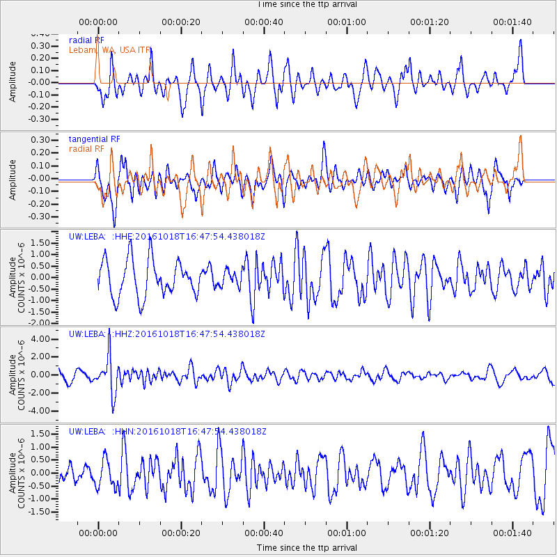
LEBA Lebam, WA, USA - Earthquake Result Viewer
*The percent match for this event was below the threshold and hence no stack was calculated.
| Earthquake location: |
South Of Fiji Islands |
| Earthquake latitude/longitude: |
-23.3/-179.9 |
| Earthquake time(UTC): |
2016/10/18 (292) 16:36:41 GMT |
| Earthquake Depth: |
540 km |
| Earthquake Magnitude: |
5.9 MWW, 6.0 MWB |
| Earthquake Catalog/Contributor: |
NEIC PDE/NEIC COMCAT |
|
| Network: |
UW Pacific Northwest Regional Seismic Network |
| Station: |
LEBA Lebam, WA, USA |
| Lat/Lon: |
46.55 N/123.56 W |
| Elevation: |
73 m |
|
| Distance: |
86.2 deg |
| Az: |
35.16 deg |
| Baz: |
230.084 deg |
| Ray Param: |
$rayparam |
*The percent match for this event was below the threshold and hence was not used in the summary stack. |
|
| Radial Match: |
72.946754 % |
| Radial Bump: |
400 |
| Transverse Match: |
57.723103 % |
| Transverse Bump: |
400 |
| SOD ConfigId: |
11737051 |
| Insert Time: |
2019-04-25 19:34:25.993 +0000 |
| GWidth: |
2.5 |
| Max Bumps: |
400 |
| Tol: |
0.001 |
|
Signal To Noise
| Channel | StoN | STA | LTA |
| UW:LEBA: :HHZ:20161018T16:47:54.438018Z | 2.9822633 | 2.1124913E-6 | 7.083517E-7 |
| UW:LEBA: :HHN:20161018T16:47:54.438018Z | 1.3245 | 5.3143646E-7 | 4.0123552E-7 |
| UW:LEBA: :HHE:20161018T16:47:54.438018Z | 0.4334776 | 3.402733E-7 | 7.849847E-7 |
| Arrivals |
| Ps | |
| PpPs | |
| PsPs/PpSs | |


