You are here: Home > Network List > CN - Canadian National Seismograph Network Stations List
> Station INK INUVIK, NT > Earthquake Result Viewer
INK INUVIK, NT - Earthquake Result Viewer
*The percent match for this event was below the threshold and hence no stack was calculated.
| Earthquake location: |
Leeward Islands |
| Earthquake latitude/longitude: |
15.2/-61.5 |
| Earthquake time(UTC): |
2016/10/18 (292) 22:08:14 GMT |
| Earthquake Depth: |
143 km |
| Earthquake Magnitude: |
5.6 MWW, 5.6 MWB |
| Earthquake Catalog/Contributor: |
NEIC PDE/NEIC COMCAT |
|
| Network: |
CN Canadian National Seismograph Network |
| Station: |
INK INUVIK, NT |
| Lat/Lon: |
68.31 N/133.53 W |
| Elevation: |
44 m |
|
| Distance: |
69.3 deg |
| Az: |
337.793 deg |
| Baz: |
101.078 deg |
| Ray Param: |
$rayparam |
*The percent match for this event was below the threshold and hence was not used in the summary stack. |
|
| Radial Match: |
57.651333 % |
| Radial Bump: |
400 |
| Transverse Match: |
71.91379 % |
| Transverse Bump: |
400 |
| SOD ConfigId: |
11737051 |
| Insert Time: |
2019-04-25 19:45:14.072 +0000 |
| GWidth: |
2.5 |
| Max Bumps: |
400 |
| Tol: |
0.001 |
|
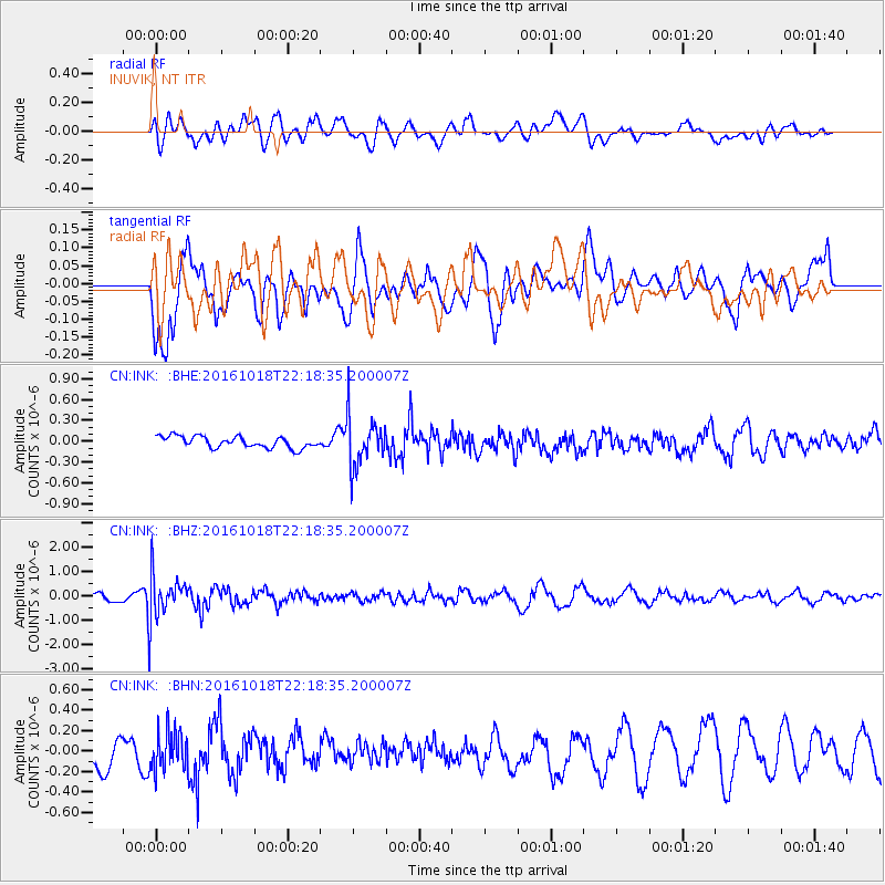
Signal To Noise
| Channel | StoN | STA | LTA |
| CN:INK: :BHZ:20161018T22:18:35.200007Z | 6.191118 | 8.7720457E-7 | 1.416876E-7 |
| CN:INK: :BHN:20161018T22:18:35.200007Z | 1.500493 | 1.9237046E-7 | 1.2820483E-7 |
| CN:INK: :BHE:20161018T22:18:35.200007Z | 4.2701006 | 3.4890962E-7 | 8.170993E-8 |
| Arrivals |
| Ps | |
| PpPs | |
| PsPs/PpSs | |


