
CMB Columbia College, Columbia, CA - Earthquake Result Viewer
| ||||||||||||||||||
| ||||||||||||||||||
| ||||||||||||||||||
|
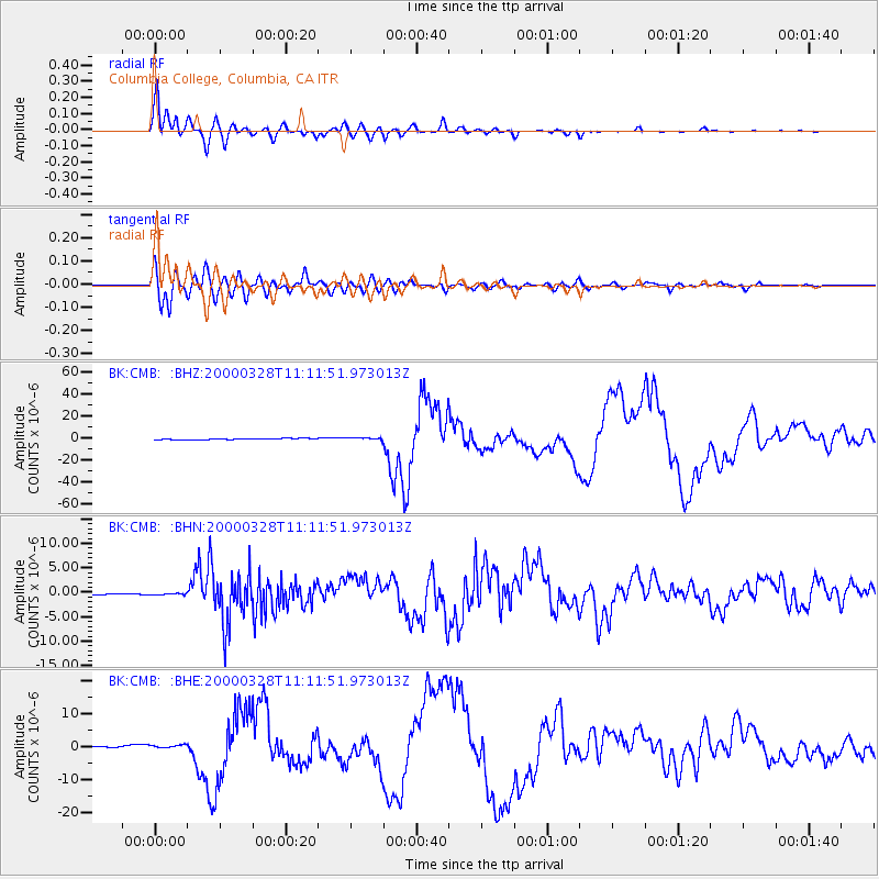
Signal To Noise
| Channel | StoN | STA | LTA |
| BK:CMB: :BHN:20000328T11:11:51.973013Z | 0.7206639 | 1.615657E-7 | 2.2419007E-7 |
| BK:CMB: :BHE:20000328T11:11:51.973013Z | 2.8815804 | 5.0789845E-7 | 1.7625692E-7 |
| BK:CMB: :BHZ:20000328T11:11:51.973013Z | 2.3959026 | 1.1356934E-6 | 4.7401488E-7 |
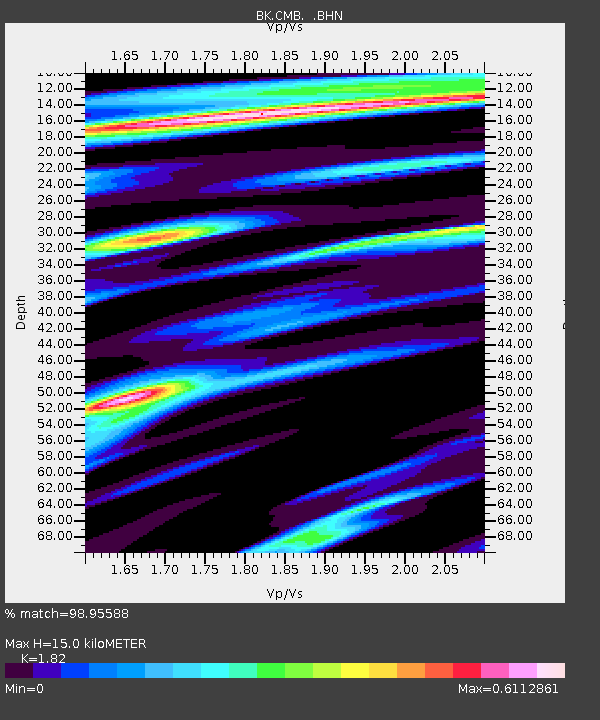
| Arrivals | |
| Ps | 1.9 SECOND |
| PpPs | 6.2 SECOND |
| PsPs/PpSs | 8.2 SECOND |

