You are here: Home > Network List > TA - USArray Transportable Network (new EarthScope stations) Stations List
> Station D25K Kavik River, AK, USA > Earthquake Result Viewer
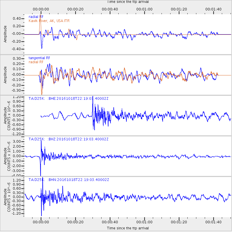
D25K Kavik River, AK, USA - Earthquake Result Viewer
*The percent match for this event was below the threshold and hence no stack was calculated.
| Earthquake location: |
Leeward Islands |
| Earthquake latitude/longitude: |
15.2/-61.5 |
| Earthquake time(UTC): |
2016/10/18 (292) 22:08:14 GMT |
| Earthquake Depth: |
143 km |
| Earthquake Magnitude: |
5.6 MWW, 5.6 MWB |
| Earthquake Catalog/Contributor: |
NEIC PDE/NEIC COMCAT |
|
| Network: |
TA USArray Transportable Network (new EarthScope stations) |
| Station: |
D25K Kavik River, AK, USA |
| Lat/Lon: |
69.32 N/146.38 W |
| Elevation: |
770 m |
|
| Distance: |
74.1 deg |
| Az: |
338.413 deg |
| Baz: |
89.295 deg |
| Ray Param: |
$rayparam |
*The percent match for this event was below the threshold and hence was not used in the summary stack. |
|
| Radial Match: |
55.515724 % |
| Radial Bump: |
400 |
| Transverse Match: |
63.91629 % |
| Transverse Bump: |
400 |
| SOD ConfigId: |
11737051 |
| Insert Time: |
2019-04-25 19:56:24.732 +0000 |
| GWidth: |
2.5 |
| Max Bumps: |
400 |
| Tol: |
0.001 |
|
Signal To Noise
| Channel | StoN | STA | LTA |
| TA:D25K: :BHZ:20161018T22:19:03.40002Z | 7.7185793 | 1.1437137E-6 | 1.4817671E-7 |
| TA:D25K: :BHN:20161018T22:19:03.40002Z | 3.748959 | 4.1224527E-7 | 1.0996259E-7 |
| TA:D25K: :BHE:20161018T22:19:03.40002Z | 3.4211292 | 4.203024E-7 | 1.2285487E-7 |
| Arrivals |
| Ps | |
| PpPs | |
| PsPs/PpSs | |


