You are here: Home > Network List > TA - USArray Transportable Network (new EarthScope stations) Stations List
> Station G21K Allakaket, AK, USA > Earthquake Result Viewer
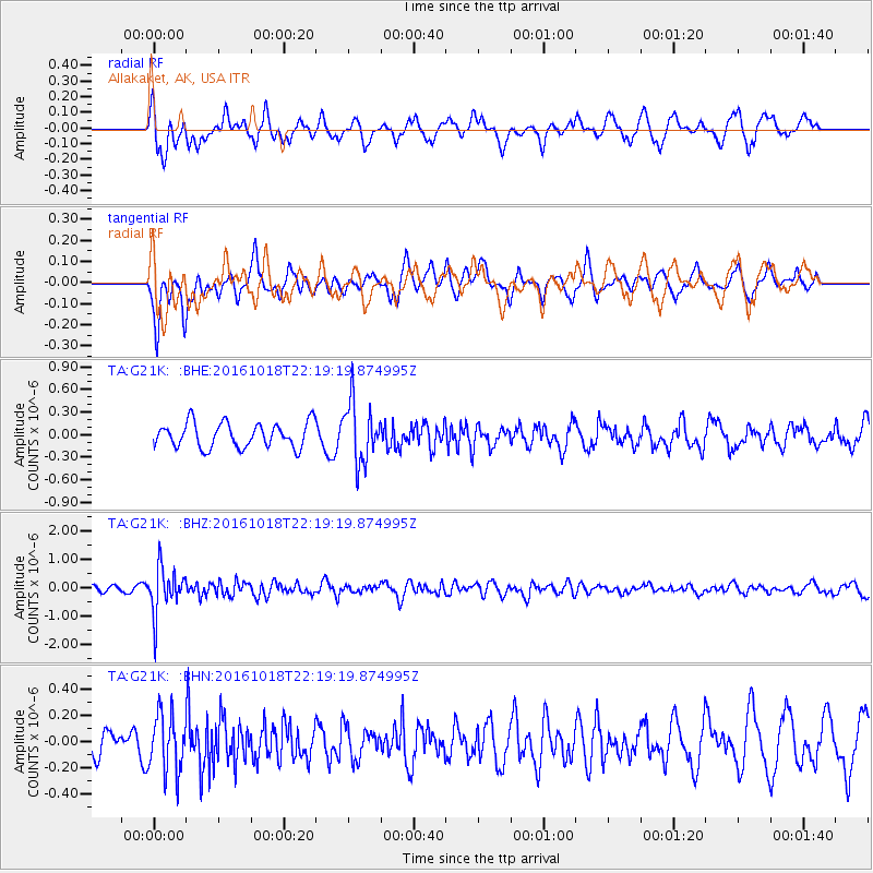
G21K Allakaket, AK, USA - Earthquake Result Viewer
*The percent match for this event was below the threshold and hence no stack was calculated.
| Earthquake location: |
Leeward Islands |
| Earthquake latitude/longitude: |
15.2/-61.5 |
| Earthquake time(UTC): |
2016/10/18 (292) 22:08:14 GMT |
| Earthquake Depth: |
143 km |
| Earthquake Magnitude: |
5.6 MWW, 5.6 MWB |
| Earthquake Catalog/Contributor: |
NEIC PDE/NEIC COMCAT |
|
| Network: |
TA USArray Transportable Network (new EarthScope stations) |
| Station: |
G21K Allakaket, AK, USA |
| Lat/Lon: |
66.52 N/153.51 W |
| Elevation: |
446 m |
|
| Distance: |
77.0 deg |
| Az: |
335.725 deg |
| Baz: |
82.017 deg |
| Ray Param: |
$rayparam |
*The percent match for this event was below the threshold and hence was not used in the summary stack. |
|
| Radial Match: |
54.77976 % |
| Radial Bump: |
400 |
| Transverse Match: |
61.18198 % |
| Transverse Bump: |
350 |
| SOD ConfigId: |
11737051 |
| Insert Time: |
2019-04-25 19:56:42.303 +0000 |
| GWidth: |
2.5 |
| Max Bumps: |
400 |
| Tol: |
0.001 |
|
Signal To Noise
| Channel | StoN | STA | LTA |
| TA:G21K: :BHZ:20161018T22:19:19.874995Z | 8.7075615 | 8.0856637E-7 | 9.285797E-8 |
| TA:G21K: :BHN:20161018T22:19:19.874995Z | 1.9728016 | 2.1665937E-7 | 1.098232E-7 |
| TA:G21K: :BHE:20161018T22:19:19.874995Z | 2.3824203 | 3.9343377E-7 | 1.6514038E-7 |
| Arrivals |
| Ps | |
| PpPs | |
| PsPs/PpSs | |


