You are here: Home > Network List > TA - USArray Transportable Network (new EarthScope stations) Stations List
> Station O17K Koliganek, Bristol Bay, AK, USA > Earthquake Result Viewer
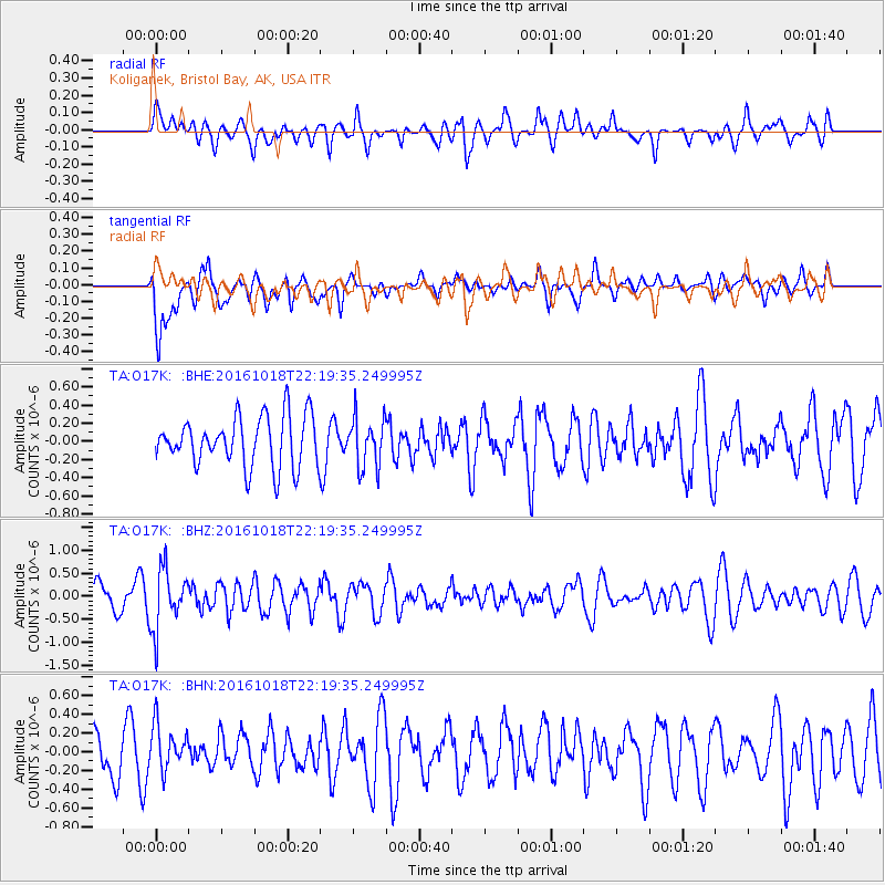
O17K Koliganek, Bristol Bay, AK, USA - Earthquake Result Viewer
*The percent match for this event was below the threshold and hence no stack was calculated.
| Earthquake location: |
Leeward Islands |
| Earthquake latitude/longitude: |
15.2/-61.5 |
| Earthquake time(UTC): |
2016/10/18 (292) 22:08:14 GMT |
| Earthquake Depth: |
143 km |
| Earthquake Magnitude: |
5.6 MWW, 5.6 MWB |
| Earthquake Catalog/Contributor: |
NEIC PDE/NEIC COMCAT |
|
| Network: |
TA USArray Transportable Network (new EarthScope stations) |
| Station: |
O17K Koliganek, Bristol Bay, AK, USA |
| Lat/Lon: |
59.77 N/157.09 W |
| Elevation: |
156 m |
|
| Distance: |
79.8 deg |
| Az: |
329.223 deg |
| Baz: |
77.501 deg |
| Ray Param: |
$rayparam |
*The percent match for this event was below the threshold and hence was not used in the summary stack. |
|
| Radial Match: |
46.80338 % |
| Radial Bump: |
400 |
| Transverse Match: |
68.91176 % |
| Transverse Bump: |
400 |
| SOD ConfigId: |
11737051 |
| Insert Time: |
2019-04-25 19:58:04.916 +0000 |
| GWidth: |
2.5 |
| Max Bumps: |
400 |
| Tol: |
0.001 |
|
Signal To Noise
| Channel | StoN | STA | LTA |
| TA:O17K: :BHZ:20161018T22:19:35.249995Z | 2.018356 | 6.481328E-7 | 3.211192E-7 |
| TA:O17K: :BHN:20161018T22:19:35.249995Z | 0.96655345 | 2.452197E-7 | 2.5370528E-7 |
| TA:O17K: :BHE:20161018T22:19:35.249995Z | 0.99560636 | 2.767264E-7 | 2.779476E-7 |
| Arrivals |
| Ps | |
| PpPs | |
| PsPs/PpSs | |


