You are here: Home > Network List > TA - USArray Transportable Network (new EarthScope stations) Stations List
> Station R33M Jennings River, BC, CAN > Earthquake Result Viewer
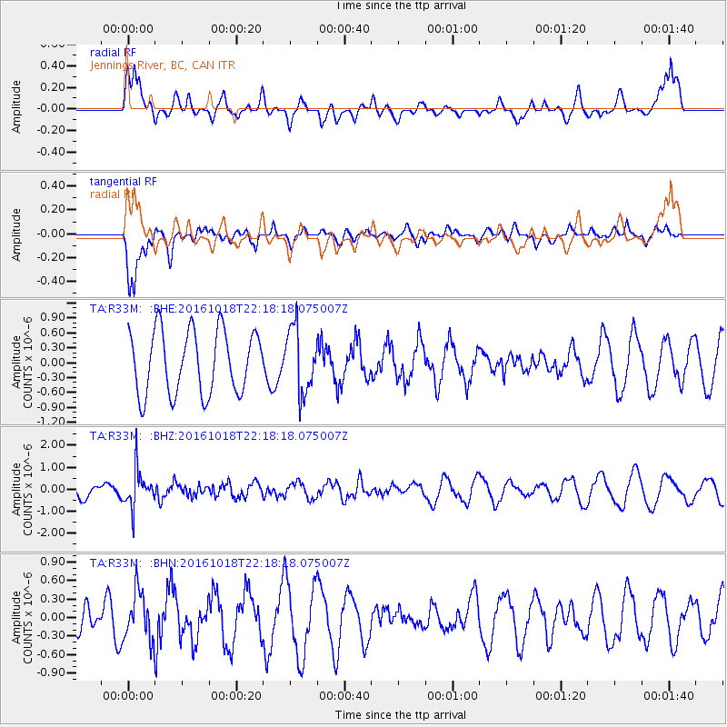
R33M Jennings River, BC, CAN - Earthquake Result Viewer
*The percent match for this event was below the threshold and hence no stack was calculated.
| Earthquake location: |
Leeward Islands |
| Earthquake latitude/longitude: |
15.2/-61.5 |
| Earthquake time(UTC): |
2016/10/18 (292) 22:08:14 GMT |
| Earthquake Depth: |
143 km |
| Earthquake Magnitude: |
5.6 MWW, 5.6 MWB |
| Earthquake Catalog/Contributor: |
NEIC PDE/NEIC COMCAT |
|
| Network: |
TA USArray Transportable Network (new EarthScope stations) |
| Station: |
R33M Jennings River, BC, CAN |
| Lat/Lon: |
59.39 N/130.97 W |
| Elevation: |
1437 m |
|
| Distance: |
66.6 deg |
| Az: |
328.523 deg |
| Baz: |
99.89 deg |
| Ray Param: |
$rayparam |
*The percent match for this event was below the threshold and hence was not used in the summary stack. |
|
| Radial Match: |
62.796722 % |
| Radial Bump: |
400 |
| Transverse Match: |
80.71211 % |
| Transverse Bump: |
361 |
| SOD ConfigId: |
11737051 |
| Insert Time: |
2019-04-25 19:58:30.578 +0000 |
| GWidth: |
2.5 |
| Max Bumps: |
400 |
| Tol: |
0.001 |
|
Signal To Noise
| Channel | StoN | STA | LTA |
| TA:R33M: :BHZ:20161018T22:18:18.075007Z | 2.4394476 | 8.640687E-7 | 3.542067E-7 |
| TA:R33M: :BHN:20161018T22:18:18.075007Z | 1.9474592 | 3.8213852E-7 | 1.9622415E-7 |
| TA:R33M: :BHE:20161018T22:18:18.075007Z | 1.0521808 | 6.6425105E-7 | 6.3130886E-7 |
| Arrivals |
| Ps | |
| PpPs | |
| PsPs/PpSs | |


