You are here: Home > Network List > CI - Caltech Regional Seismic Network Stations List
> Station MPM Manuel Prospect Mine, California, USA > Earthquake Result Viewer
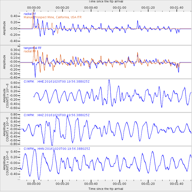
MPM Manuel Prospect Mine, California, USA - Earthquake Result Viewer
*The percent match for this event was below the threshold and hence no stack was calculated.
| Earthquake location: |
Northern Mid-Atlantic Ridge |
| Earthquake latitude/longitude: |
13.3/-44.9 |
| Earthquake time(UTC): |
2016/10/20 (294) 00:09:26 GMT |
| Earthquake Depth: |
10 km |
| Earthquake Magnitude: |
5.7 MWP |
| Earthquake Catalog/Contributor: |
NEIC PDE/NEIC COMCAT |
|
| Network: |
CI Caltech Regional Seismic Network |
| Station: |
MPM Manuel Prospect Mine, California, USA |
| Lat/Lon: |
36.06 N/117.49 W |
| Elevation: |
185 m |
|
| Distance: |
68.3 deg |
| Az: |
303.672 deg |
| Baz: |
89.079 deg |
| Ray Param: |
$rayparam |
*The percent match for this event was below the threshold and hence was not used in the summary stack. |
|
| Radial Match: |
65.165764 % |
| Radial Bump: |
400 |
| Transverse Match: |
66.57863 % |
| Transverse Bump: |
378 |
| SOD ConfigId: |
11737051 |
| Insert Time: |
2019-04-25 20:18:56.829 +0000 |
| GWidth: |
2.5 |
| Max Bumps: |
400 |
| Tol: |
0.001 |
|
Signal To Noise
| Channel | StoN | STA | LTA |
| CI:MPM: :HHZ:20161020T00:19:56.388025Z | 1.1606162 | 2.370411E-7 | 2.042373E-7 |
| CI:MPM: :HHN:20161020T00:19:56.388025Z | 1.8385891 | 4.0125371E-7 | 2.1824002E-7 |
| CI:MPM: :HHE:20161020T00:19:56.388025Z | 1.2637228 | 2.2725001E-7 | 1.7982583E-7 |
| Arrivals |
| Ps | |
| PpPs | |
| PsPs/PpSs | |


