You are here: Home > Network List > CI - Caltech Regional Seismic Network Stations List
> Station BFS Mt Baldy Forest Station > Earthquake Result Viewer
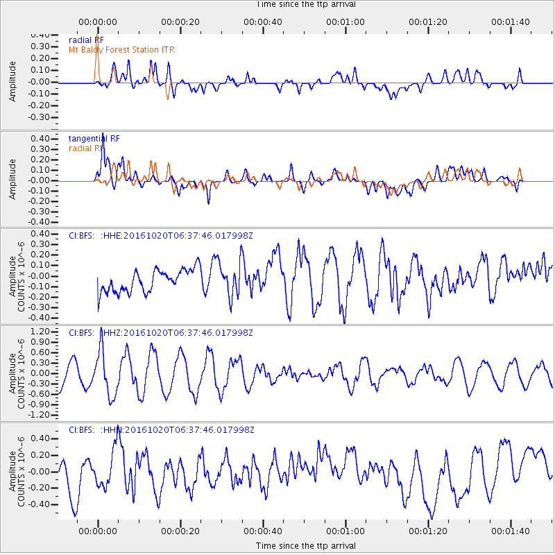
BFS Mt Baldy Forest Station - Earthquake Result Viewer
*The percent match for this event was below the threshold and hence no stack was calculated.
| Earthquake location: |
Volcano Islands, Japan Region |
| Earthquake latitude/longitude: |
22.3/143.8 |
| Earthquake time(UTC): |
2016/10/20 (294) 06:25:56 GMT |
| Earthquake Depth: |
108 km |
| Earthquake Magnitude: |
5.7 MB |
| Earthquake Catalog/Contributor: |
NEIC PDE/NEIC COMCAT |
|
| Network: |
CI Caltech Regional Seismic Network |
| Station: |
BFS Mt Baldy Forest Station |
| Lat/Lon: |
34.24 N/117.66 W |
| Elevation: |
1312 m |
|
| Distance: |
84.5 deg |
| Az: |
55.387 deg |
| Baz: |
293.046 deg |
| Ray Param: |
$rayparam |
*The percent match for this event was below the threshold and hence was not used in the summary stack. |
|
| Radial Match: |
47.220215 % |
| Radial Bump: |
400 |
| Transverse Match: |
64.45212 % |
| Transverse Bump: |
400 |
| SOD ConfigId: |
11737051 |
| Insert Time: |
2019-04-25 20:39:40.723 +0000 |
| GWidth: |
2.5 |
| Max Bumps: |
400 |
| Tol: |
0.001 |
|
Signal To Noise
| Channel | StoN | STA | LTA |
| CI:BFS: :HHZ:20161020T06:37:46.017998Z | 1.8058455 | 6.7301596E-7 | 3.7268745E-7 |
| CI:BFS: :HHN:20161020T06:37:46.017998Z | 0.8877003 | 2.3423391E-7 | 2.6386599E-7 |
| CI:BFS: :HHE:20161020T06:37:46.017998Z | 1.54489 | 1.6246857E-7 | 1.0516513E-7 |
| Arrivals |
| Ps | |
| PpPs | |
| PsPs/PpSs | |


