You are here: Home > Network List > CI - Caltech Regional Seismic Network Stations List
> Station MPP McPhearson Peak > Earthquake Result Viewer
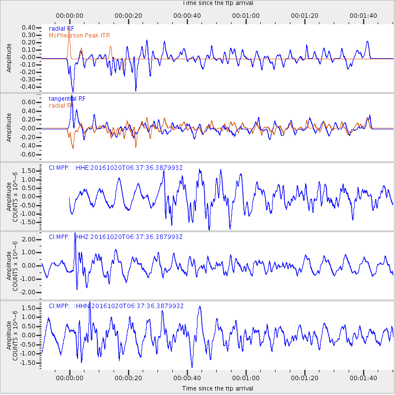
MPP McPhearson Peak - Earthquake Result Viewer
*The percent match for this event was below the threshold and hence no stack was calculated.
| Earthquake location: |
Volcano Islands, Japan Region |
| Earthquake latitude/longitude: |
22.3/143.8 |
| Earthquake time(UTC): |
2016/10/20 (294) 06:25:56 GMT |
| Earthquake Depth: |
108 km |
| Earthquake Magnitude: |
5.7 MB |
| Earthquake Catalog/Contributor: |
NEIC PDE/NEIC COMCAT |
|
| Network: |
CI Caltech Regional Seismic Network |
| Station: |
MPP McPhearson Peak |
| Lat/Lon: |
34.89 N/119.81 W |
| Elevation: |
1739 m |
|
| Distance: |
82.6 deg |
| Az: |
55.468 deg |
| Baz: |
291.838 deg |
| Ray Param: |
$rayparam |
*The percent match for this event was below the threshold and hence was not used in the summary stack. |
|
| Radial Match: |
75.432884 % |
| Radial Bump: |
400 |
| Transverse Match: |
71.440994 % |
| Transverse Bump: |
400 |
| SOD ConfigId: |
11737051 |
| Insert Time: |
2019-04-25 20:40:12.967 +0000 |
| GWidth: |
2.5 |
| Max Bumps: |
400 |
| Tol: |
0.001 |
|
Signal To Noise
| Channel | StoN | STA | LTA |
| CI:MPP: :HHZ:20161020T06:37:36.387993Z | 2.0441601 | 8.93602E-7 | 4.3714874E-7 |
| CI:MPP: :HHN:20161020T06:37:36.387993Z | 1.4787793 | 6.235565E-7 | 4.2166974E-7 |
| CI:MPP: :HHE:20161020T06:37:36.387993Z | 1.6367252 | 8.019859E-7 | 4.8999425E-7 |
| Arrivals |
| Ps | |
| PpPs | |
| PsPs/PpSs | |


