You are here: Home > Network List > TA - USArray Transportable Network (new EarthScope stations) Stations List
> Station D23K Nanushuk River, AK USA > Earthquake Result Viewer
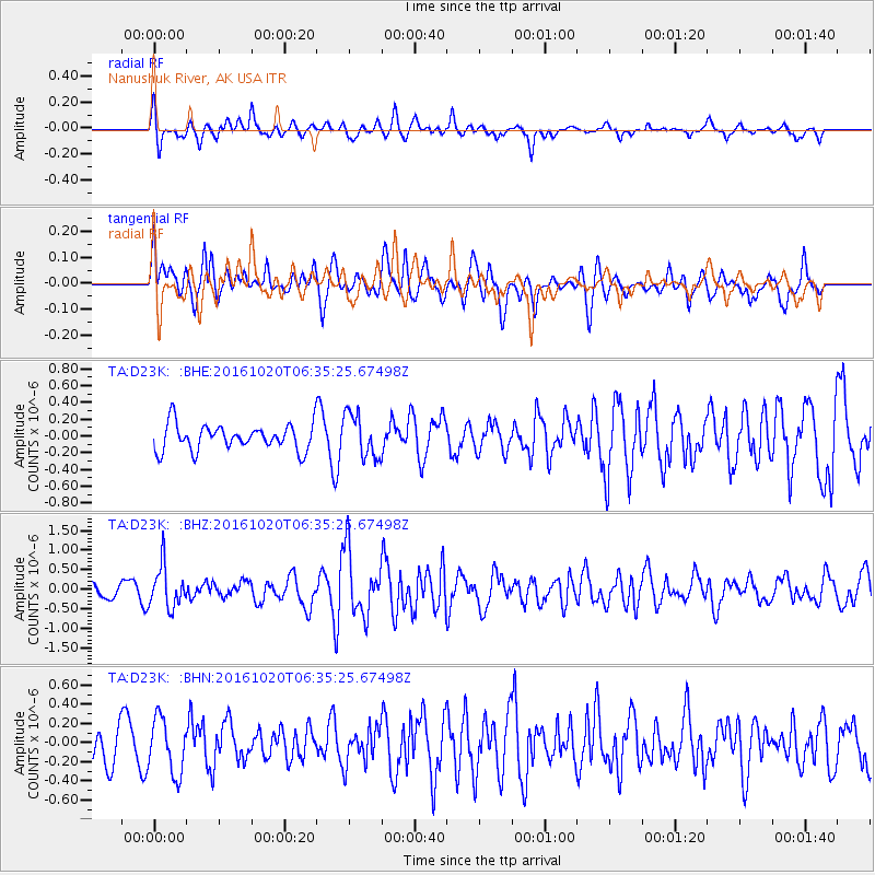
D23K Nanushuk River, AK USA - Earthquake Result Viewer
*The percent match for this event was below the threshold and hence no stack was calculated.
| Earthquake location: |
Volcano Islands, Japan Region |
| Earthquake latitude/longitude: |
22.3/143.8 |
| Earthquake time(UTC): |
2016/10/20 (294) 06:25:56 GMT |
| Earthquake Depth: |
108 km |
| Earthquake Magnitude: |
5.7 MB |
| Earthquake Catalog/Contributor: |
NEIC PDE/NEIC COMCAT |
|
| Network: |
TA USArray Transportable Network (new EarthScope stations) |
| Station: |
D23K Nanushuk River, AK USA |
| Lat/Lon: |
68.97 N/150.68 W |
| Elevation: |
406 m |
|
| Distance: |
60.7 deg |
| Az: |
22.148 deg |
| Baz: |
255.296 deg |
| Ray Param: |
$rayparam |
*The percent match for this event was below the threshold and hence was not used in the summary stack. |
|
| Radial Match: |
56.705982 % |
| Radial Bump: |
391 |
| Transverse Match: |
67.52192 % |
| Transverse Bump: |
400 |
| SOD ConfigId: |
11737051 |
| Insert Time: |
2019-04-25 20:49:40.902 +0000 |
| GWidth: |
2.5 |
| Max Bumps: |
400 |
| Tol: |
0.001 |
|
Signal To Noise
| Channel | StoN | STA | LTA |
| TA:D23K: :BHZ:20161020T06:35:25.67498Z | 1.9260598 | 5.2909064E-7 | 2.7470102E-7 |
| TA:D23K: :BHN:20161020T06:35:25.67498Z | 1.7610095 | 2.8496308E-7 | 1.6181802E-7 |
| TA:D23K: :BHE:20161020T06:35:25.67498Z | 1.6829665 | 2.6201286E-7 | 1.5568513E-7 |
| Arrivals |
| Ps | |
| PpPs | |
| PsPs/PpSs | |


