You are here: Home > Network List > TA - USArray Transportable Network (new EarthScope stations) Stations List
> Station D25K Kavik River, AK, USA > Earthquake Result Viewer
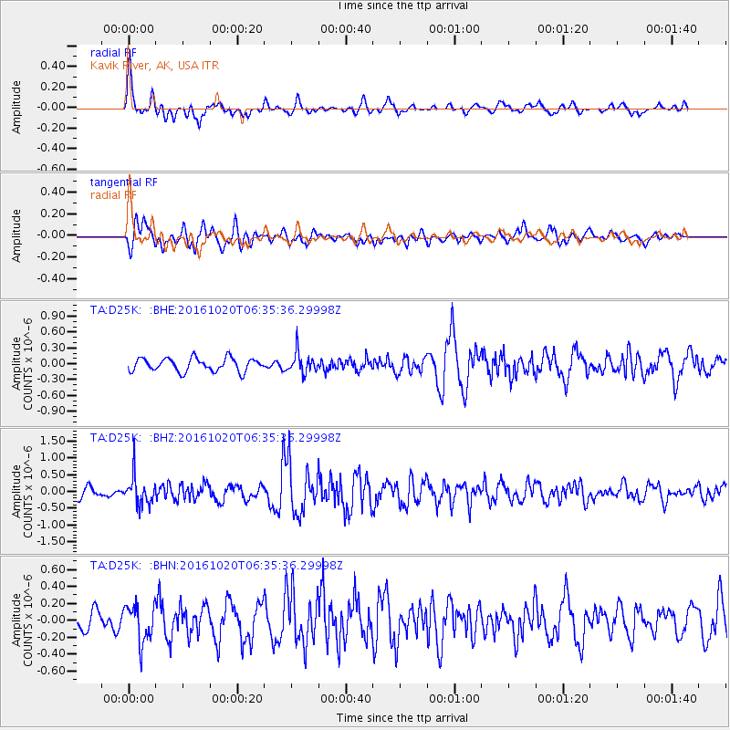
D25K Kavik River, AK, USA - Earthquake Result Viewer
*The percent match for this event was below the threshold and hence no stack was calculated.
| Earthquake location: |
Volcano Islands, Japan Region |
| Earthquake latitude/longitude: |
22.3/143.8 |
| Earthquake time(UTC): |
2016/10/20 (294) 06:25:56 GMT |
| Earthquake Depth: |
108 km |
| Earthquake Magnitude: |
5.7 MB |
| Earthquake Catalog/Contributor: |
NEIC PDE/NEIC COMCAT |
|
| Network: |
TA USArray Transportable Network (new EarthScope stations) |
| Station: |
D25K Kavik River, AK, USA |
| Lat/Lon: |
69.32 N/146.38 W |
| Elevation: |
770 m |
|
| Distance: |
62.3 deg |
| Az: |
22.137 deg |
| Baz: |
259.311 deg |
| Ray Param: |
$rayparam |
*The percent match for this event was below the threshold and hence was not used in the summary stack. |
|
| Radial Match: |
65.677055 % |
| Radial Bump: |
400 |
| Transverse Match: |
73.35715 % |
| Transverse Bump: |
400 |
| SOD ConfigId: |
11737051 |
| Insert Time: |
2019-04-25 20:49:49.587 +0000 |
| GWidth: |
2.5 |
| Max Bumps: |
400 |
| Tol: |
0.001 |
|
Signal To Noise
| Channel | StoN | STA | LTA |
| TA:D25K: :BHZ:20161020T06:35:36.29998Z | 2.3532495 | 4.2290594E-7 | 1.7971148E-7 |
| TA:D25K: :BHN:20161020T06:35:36.29998Z | 2.5205958 | 2.2303134E-7 | 8.848358E-8 |
| TA:D25K: :BHE:20161020T06:35:36.29998Z | 1.5621408 | 1.9534056E-7 | 1.2504671E-7 |
| Arrivals |
| Ps | |
| PpPs | |
| PsPs/PpSs | |


