You are here: Home > Network List > TA - USArray Transportable Network (new EarthScope stations) Stations List
> Station TPFO Pinon Flats, CA, USA > Earthquake Result Viewer
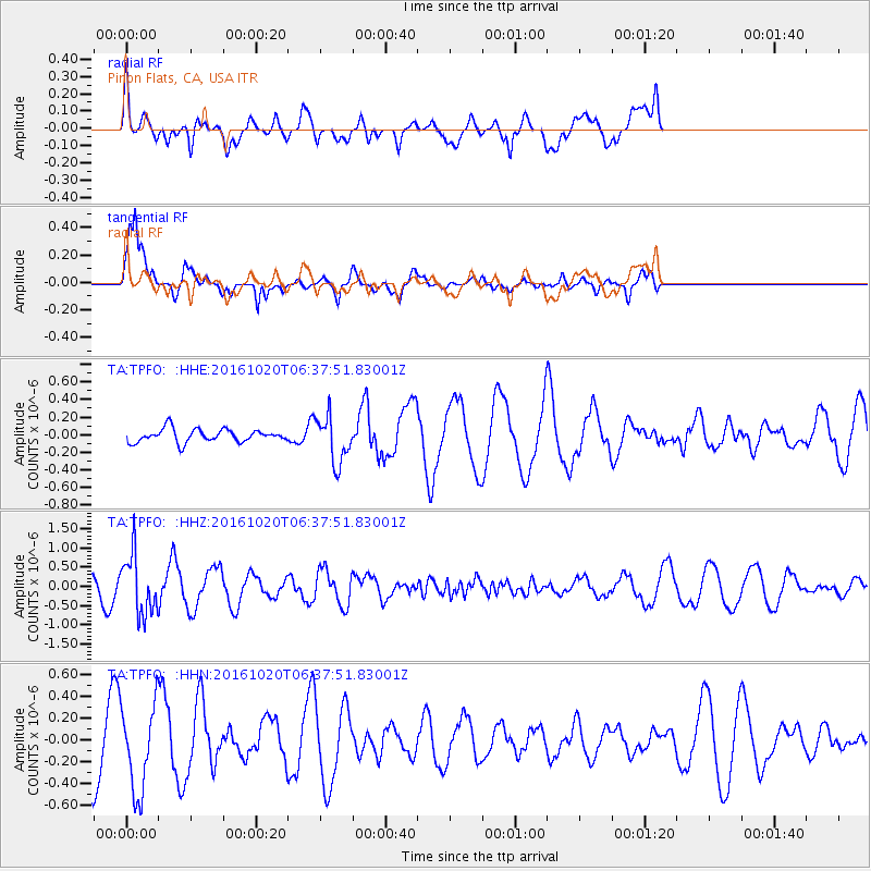
TPFO Pinon Flats, CA, USA - Earthquake Result Viewer
*The percent match for this event was below the threshold and hence no stack was calculated.
| Earthquake location: |
Volcano Islands, Japan Region |
| Earthquake latitude/longitude: |
22.3/143.8 |
| Earthquake time(UTC): |
2016/10/20 (294) 06:25:56 GMT |
| Earthquake Depth: |
108 km |
| Earthquake Magnitude: |
5.7 MB |
| Earthquake Catalog/Contributor: |
NEIC PDE/NEIC COMCAT |
|
| Network: |
TA USArray Transportable Network (new EarthScope stations) |
| Station: |
TPFO Pinon Flats, CA, USA |
| Lat/Lon: |
33.61 N/116.45 W |
| Elevation: |
1275 m |
|
| Distance: |
85.6 deg |
| Az: |
55.57 deg |
| Baz: |
293.731 deg |
| Ray Param: |
$rayparam |
*The percent match for this event was below the threshold and hence was not used in the summary stack. |
|
| Radial Match: |
56.813923 % |
| Radial Bump: |
400 |
| Transverse Match: |
68.85484 % |
| Transverse Bump: |
356 |
| SOD ConfigId: |
11737051 |
| Insert Time: |
2019-04-25 20:51:05.981 +0000 |
| GWidth: |
2.5 |
| Max Bumps: |
400 |
| Tol: |
0.001 |
|
Signal To Noise
| Channel | StoN | STA | LTA |
| TA:TPFO: :HHZ:20161020T06:37:51.83001Z | 2.7949326 | 7.8124174E-7 | 2.7952078E-7 |
| TA:TPFO: :HHN:20161020T06:37:51.83001Z | 1.5188898 | 3.9743853E-7 | 2.6166384E-7 |
| TA:TPFO: :HHE:20161020T06:37:51.83001Z | 3.4843328 | 2.6000333E-7 | 7.46207E-8 |
| Arrivals |
| Ps | |
| PpPs | |
| PsPs/PpSs | |


