You are here: Home > Network List > GS - US Geological Survey Networks Stations List
> Station DEC12 Decatur Surface Seismic Site, Decatur, IL, USA > Earthquake Result Viewer
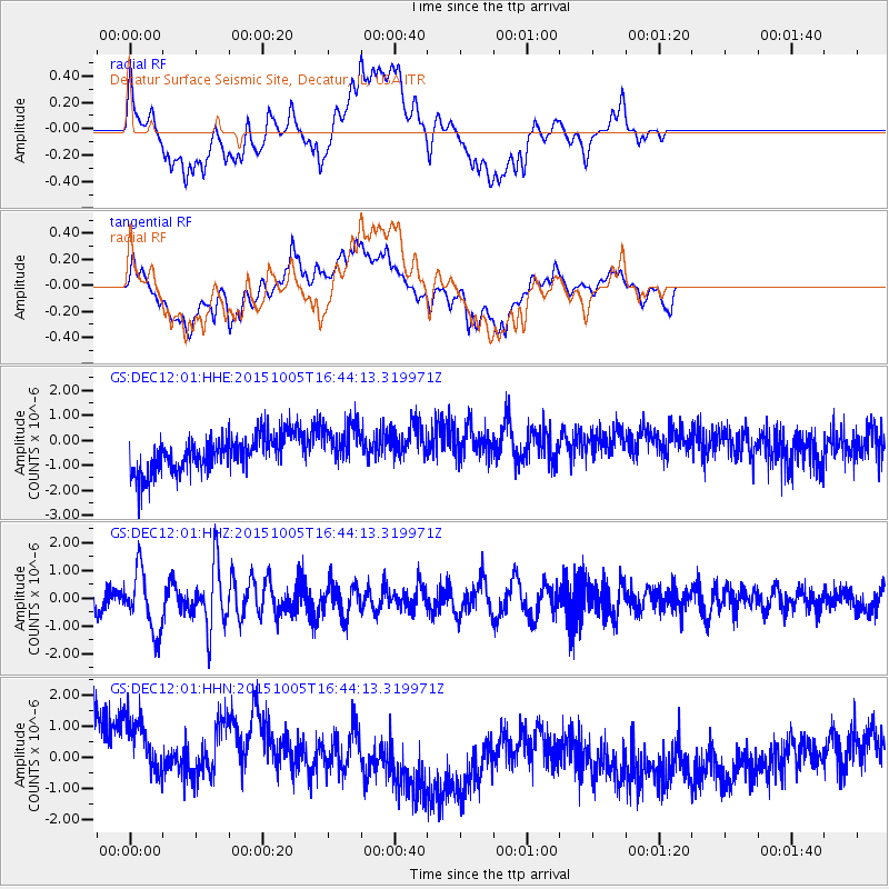
DEC12 Decatur Surface Seismic Site, Decatur, IL, USA - Earthquake Result Viewer
*The percent match for this event was below the threshold and hence no stack was calculated.
| Earthquake location: |
Near Coast Of Central Chile |
| Earthquake latitude/longitude: |
-30.3/-71.7 |
| Earthquake time(UTC): |
2015/10/05 (278) 16:33:26 GMT |
| Earthquake Depth: |
35 km |
| Earthquake Magnitude: |
6.0 MB |
| Earthquake Catalog/Contributor: |
NEIC PDE/NEIC ALERT |
|
| Network: |
GS US Geological Survey Networks |
| Station: |
DEC12 Decatur Surface Seismic Site, Decatur, IL, USA |
| Lat/Lon: |
39.91 N/88.91 W |
| Elevation: |
208 m |
|
| Distance: |
71.7 deg |
| Az: |
346.108 deg |
| Baz: |
164.338 deg |
| Ray Param: |
$rayparam |
*The percent match for this event was below the threshold and hence was not used in the summary stack. |
|
| Radial Match: |
22.914322 % |
| Radial Bump: |
400 |
| Transverse Match: |
25.695713 % |
| Transverse Bump: |
400 |
| SOD ConfigId: |
1156111 |
| Insert Time: |
2015-10-19 17:12:36.982 +0000 |
| GWidth: |
2.5 |
| Max Bumps: |
400 |
| Tol: |
0.001 |
|
Signal To Noise
| Channel | StoN | STA | LTA |
| GS:DEC12:01:HHZ:20151005T16:44:13.319971Z | 2.990008 | 1.080723E-6 | 3.6144482E-7 |
| GS:DEC12:01:HHN:20151005T16:44:13.319971Z | 1.4206475 | 1.9454014E-6 | 1.3693766E-6 |
| GS:DEC12:01:HHE:20151005T16:44:13.319971Z | 1.2536739 | 8.998699E-7 | 7.1778624E-7 |
| Arrivals |
| Ps | |
| PpPs | |
| PsPs/PpSs | |


