You are here: Home > Network List > TA - USArray Transportable Network (new EarthScope stations) Stations List
> Station L19K White Mountain, AK, USA > Earthquake Result Viewer
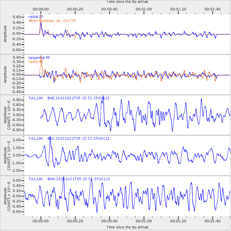
L19K White Mountain, AK, USA - Earthquake Result Viewer
*The percent match for this event was below the threshold and hence no stack was calculated.
| Earthquake location: |
Western Honshu, Japan |
| Earthquake latitude/longitude: |
35.4/133.8 |
| Earthquake time(UTC): |
2016/10/21 (295) 05:07:23 GMT |
| Earthquake Depth: |
10 km |
| Earthquake Magnitude: |
6.2 MWW, 6.6 MI |
| Earthquake Catalog/Contributor: |
NEIC PDE/NEIC COMCAT |
|
| Network: |
TA USArray Transportable Network (new EarthScope stations) |
| Station: |
L19K White Mountain, AK, USA |
| Lat/Lon: |
62.18 N/154.85 W |
| Elevation: |
650 m |
|
| Distance: |
50.8 deg |
| Az: |
34.973 deg |
| Baz: |
272.909 deg |
| Ray Param: |
$rayparam |
*The percent match for this event was below the threshold and hence was not used in the summary stack. |
|
| Radial Match: |
68.11951 % |
| Radial Bump: |
400 |
| Transverse Match: |
55.732788 % |
| Transverse Bump: |
400 |
| SOD ConfigId: |
11737051 |
| Insert Time: |
2019-04-25 21:11:10.985 +0000 |
| GWidth: |
2.5 |
| Max Bumps: |
400 |
| Tol: |
0.001 |
|
Signal To Noise
| Channel | StoN | STA | LTA |
| TA:L19K: :BHZ:20161021T05:15:53.350011Z | 4.9394355 | 7.689273E-7 | 1.556711E-7 |
| TA:L19K: :BHN:20161021T05:15:53.350011Z | 1.5031934 | 2.3147135E-7 | 1.539864E-7 |
| TA:L19K: :BHE:20161021T05:15:53.350011Z | 1.4537506 | 3.68258E-7 | 2.533158E-7 |
| Arrivals |
| Ps | |
| PpPs | |
| PsPs/PpSs | |


